Tropical Storm Jerry
Tropical Depression #11 turned into Tropical Storm Jerry
today (we're still doing better than the Western Pacific, where Tropical Depression #22 (!!!) turned into Tropical Storm Fitow today). I agree with this upgrade because the circulation that was absent from
the middle levels of the troposphere yesterday improved today. He is at 27.3N, 44.9W, still heading east at 7mph. He is pretty weak with winds of 40mph, central pressure is estimated to be 1008mb. He's been heading a little more east than yesterday's track showed:

But the NHC think he'll make that turn back to the west any minute now. I'm not 100% sure about this yet, but I do see it as a possible scenario because the high pressure will develop to his north and northwest.
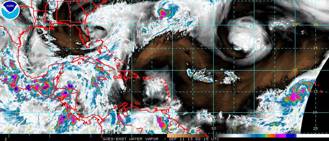
The
convection also continued to persist during the day but it has been slowly decreasing as we see if we compare an infrared satellite image from mid-afternoon:

with this one three hours later:

The major convection is still to the northeast of the center, so there is still some wind shear but not as much as yesterday. Water temperatures are warm enough for the storm to develop, with surface temperatures around 27-28 deg C, and the upper 50-75m warmer than 26.5 deg C. However there is a lot of dry air to the southeast of Jerry, which is squelching the convection:

If he does take that forecast track to the west, he'll be moving away from the dry air and I think he will intensify. His circulation is continuing to improve throughout the troposphere so there's a chance he may even reach hurricane strength, although currently the NHC don't forecast his wind speed exceeding 45mph at any point in the next 5 days.
Caribbean Blobette
This little thing now has a 20% chance of developing into something in the next 2 days. There's a bit of circulation, but she's mostly just convection at the moment. She is over some very warm waters, so definitely worth keeping an eye on!
That's all for today. Now I think...

How cool is that?!? :-) I found napkins with one of my catch-phrases on it! They say imitation is the sincerest form of flattery! ;-)
Until tomorrow!
J.
Blogs archived at http://jyotikastorms.blogspot.com/
Twitter @JyovianStorm
-------------------------------
DISCLAIMER: These remarks are just what I think/see regarding tropical storms - not the opinion of any organization I represent. If you are making an evacuation decision, please heed your local emergency management and the National Hurricane Center's official forecast and the National Weather Service announcements. This is not an official forecast. If I "run away, run away" (Monty Python), I'll let you know.
-----------------------------