
The theme for this week is 'it's too soon to say':
- full extent of damage caused by Super Typhoon Goni in the Philippines on Sunday - pending
- results of US Election on Tuesday - pending
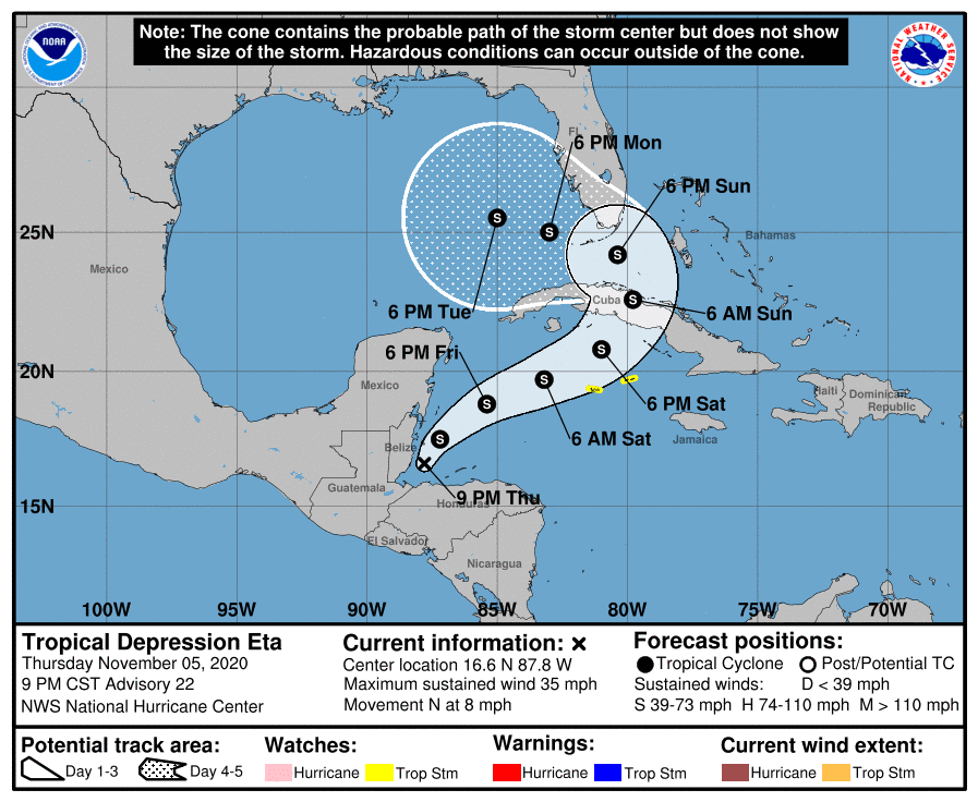
- full extent of Hurricane Eta in Central America on Tuesday/Wednesday/Thursday - pending. Although unfortunately at least 70 people have lost their lives in this one so far.
Eta is now back in the Caribbean and over some very warm water. It's at 16.6N, 87.8W, heading N at 8mph.
There is some convection as we can see in the satellite imagery, but it's a bit of a messy blob:

There isn't a lot of very well developed vorticity in the troposphere at any level. Here's the map from the lowest level which has the 'strongest' signal - it's a little 'redder' just off the northern coast of Honduras so I think that is what the NHC is picking up as the Tropical Depression.

Toodle pip for now!
J.
p.s. happy Bonfire Night in the UK!
Twitter: jyovianstorm
--------------------------------------
DISCLAIMER:
These remarks are just what I think/see regarding tropical storms - not the opinion of any organization I represent. If you are making an evacuation decision, please heed your local emergency management and the National Hurricane Center's official forecast and local weather service announcements. This is not an official forecast. If I "run away, run away" (Monty Python), I'll let you know.
--------------------------------------


No comments:
Post a Comment