What a lovely piece of art...
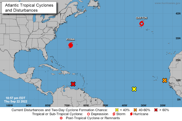
It's getting a tinsy bit crowded out there!
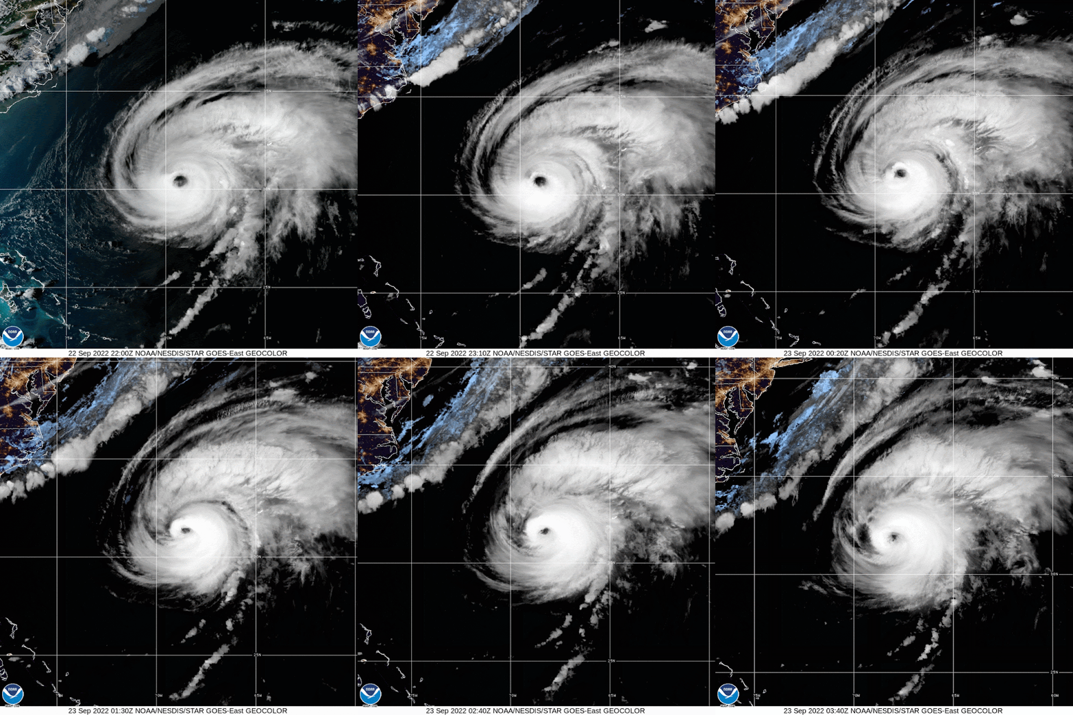
Hurricane FionaShe is now at 31.9N, 68.1W, heading NNE at a very-much-faster-than-the-last-few-days speed of 21 mph! This means she is beginning to interact with a front which we can also see really clearly from her satellite image - the clouds associated with the front are sweeping in from the northwest in a line:
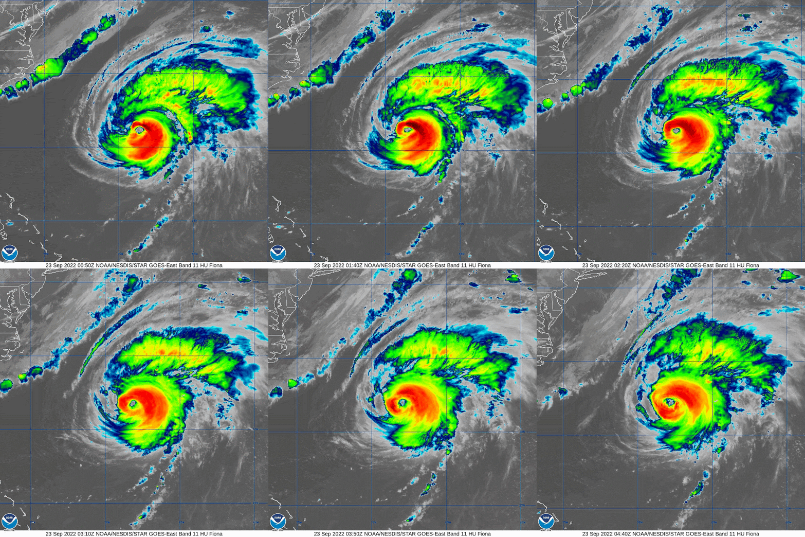
There hasn't been any change in the official intensity yet, with winds still at 130mph - meaning she is a borderline cat 3/cat 4 storm (cat 4 range: 130-156mph), central pressure is 932mb. However, we can really see the weakening on the west side of the storm today - with dry air and wind shear both impacting her, so I am not sure she really is that strong. She does still have a clear eye, so I think she is more likely a 120-125mph cat 3 storm. The infrared satellite is showing that dry air very clearly on the west side:
Bermuda is experiencing a lot of rain and possibly some thundery weather at the moment. If you can't find Bermuda (and who can? ;-)) under all of that convection, it may be easier to see in the image above. It looks like they have some more severe weather heading their way before she leaves the 'hood, so I hope all of you on the island have your wellies and raincoats handy and aren't on a golf course with a metal club in hand!
Looking ahead, she will get to Canada by Saturday morning:
There is some strong wind shear in front of her so she will no longer be a major hurricane by the time she gets to Nova Scotia (which means she won't be a cat 3 or higher storm) - the NHC think she will most likely be a weak cat 2 storm by then. This seems likely because, although there is some strong wind shear, she still has to cross the warm waters of the Gulf Stream which will give her an energy boost. Along with that, she will be interacting with that front so some of her energy will be from that versus a normal tropical storm which gets all its energy from the ocean. For her to be weaker, that wind shear needs to kick in sooner - something to watch for tomorrow (Friday). I hope you guys in Canada are ready! Stay safe up there (as well as on Bermuda)!
Tropical Storm Gaston
Not much change from yesterday other than the location really. He's now at 41N, 31 W, heading E at 12mph. Still a Tropical Storm with 65mph winds, central pressure is 999mb. The Azores has a breezy sort of weekend ahead:
Caribbean Blobette
Known a couple of days ago as the Atlantic Blobette, this one is now firmly in the Caribbean and may be Tropical Storm Hermine soon. She has some good circulation in the lowest level of the troposphere, but the structure isn't as robust in the mid-levels yet so she isn't a Tropical Storm yet. She is around 13N, 67W, heading WNW at 10-15mph.
As for the other two blobs, I'll leave those alone for today because it's time for a long nap in this time zone.
Ciao,
J.
Blogs archived at http://jyotikastorms.blogspot.com/
DISCLAIMER:
These remarks are just what I think/see regarding tropical storms - not the opinion of any organization I represent. If you are making an evacuation decision, please heed your local emergency management and the National Hurricane Center's official forecast and local weather service announcements. This is not an official forecast. If I "run away, run away" (Monty Python), I'll let you know.


No comments:
Post a Comment