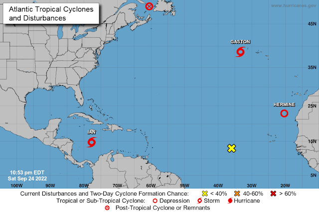
Today it's all About A Boy called Ian, although there are a few other names still floating around:
But Fiona and Gaston are on the decline, and Hermine is now just a Tropical Depression, so that leaves...
Tropical Storm Ian
He is currently at 14.7N, 77.7W, heading W at 13mph. He continued on a more westward track than forecast yesterday because the high pressure to his north remained strong. I don't have good data on the pressure fields anymore but it looks like the high pressure to his north may be starting to weaken he may start to move a little towards the north soon.
In case you are wondering why the NHC (who are using models) are sure he will make that WNW and then NW turn, despite him taking a more westward track than expected for today, let me tell you why...
<Science Alert!> Storm tracks: In the northern hemisphere 'things' (technical jargon ;-)) tend to move clockwise around high pressure systems, and counter-clockwise around low pressure systems. For example, a tropical storm has low pressure in the center so winds (aka 'things') move counter-clockwise (or anticlockwise if you prefer) around a storm. Similarly, tropical storms (aka 'things') also move around larger pressure systems. There is generally a region of high pressure that likes to hang out over the Atlantic, sometimes called the Bermuda High or the Bermuda-Azores High. You can imagine it as a big clock face over the Atlantic, like this:
(Image credit: Moi!)
As storms cross the ocean, they move westward along the six o'clock region. As they turn WNW and NW they are moving from 6 to 9. Then they move N and NE, from 9 to 12. Of course, this imaginary clock face isn't nice and round, nor does it stay in the same place (otherwise forecasting the track would be easy peasy :-)). It's like a Dali clock face, with wiggly bits (more technical jargon ;-)) that are always moving:
Sometimes this high pressure stays out in the Atlantic and we don’t see many storms making landfall, and at other times the high pressure extends across the Caribbean and storms end up in Central America instead of turning north. In Ian's case, there is a high pressure to his north, which means he continued westward. However, as that weakens, he will start to move clockwise around that.
The NHC track forecast is based on the output from a number of models, and these track models are all trying to predict the changes in the pressure fields around the world which is why they are all a little different - depending on how they do that prediction. The pressure field really is quite complicated - it's not only how it changes horizontally but also how it changes vertically that needs to be considered. To show you how complicated this is, here is a representation of the pressure field in the middle of the troposphere (around 5km above the surface of the Earth):
As you see, lots of squiggles that are all wiggling about at the same time! <End of Science Alert!>
As for his intensity, at the moment his winds are only 50mph, central pressure 1002 mb which means he is still a relatively weak Tropical Storm (TS range: 39-73mph). The two main factors for intensity at the moment are wind shear and water temperature (the air is fairly humid around him and he isn't near any land so those two aren't at play today).
Water temperature: Ian is currently over the toasty waters of the Caribbean with sea surface temperatures over 29 deg C, however in an area where only the upper 50m of the water column is warmer than 26 deg C which is why his convection is not very strong - especially to the south of the circulation where the water is a little cooler. But soon he will be moving over an area where the upper 100m of the water column is warmer than 26 deg C and that will really help him to intensify tomorrow, and by Monday, he'll be over a region with sea surface temperatures warmer than 30 deg C with the upper 150m is warmer than 26 deg C - that is when he is expected to become a major hurricane.
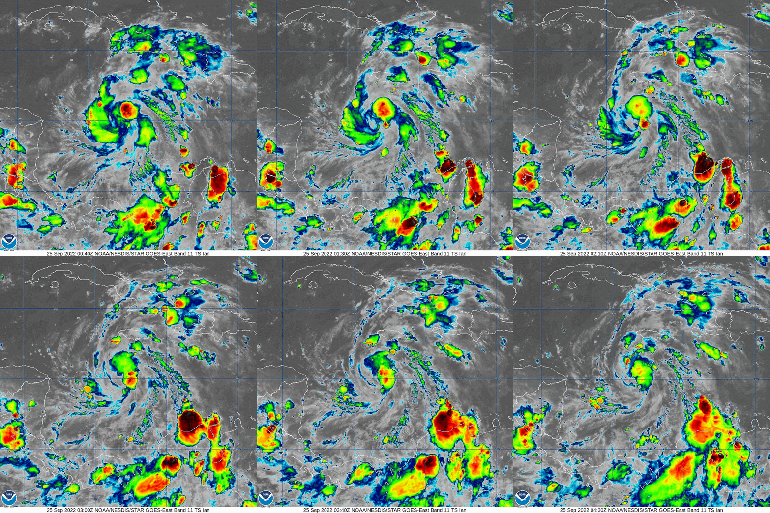
Wind Shear: He also hasn't intensified a lot today because of wind shear but this is decreasing and everything else is in favour of his intensification tomorrow. Until earlier today, his convection was not in the same location as the circulation, however that has now come into alignment...
His circulation is pretty good in the lower half of the troposphere and I do now see some circulation in the upper levels of the troposphere now which suggests that he is already stronger than the 50mph winds would suggest.
I agree with the NHC forecast that he will intensify tomorrow. They think he'll be a cat 1 storm by this time tomorrow and I think he may be a little faster than that and become a cat 1 storm a bit earlier in the day - but either way, he'll become a bit better looking tomorrow.
Although the track at less than 5 days is really uncertain (3/4 of the State of Florida is currently in the Cone of Uncertainty), I know you will be ready in Florida and the northern Gulf coast...
Ciao for now,
J.
Blogs archived at http://jyotikastorms.blogspot.com/
DISCLAIMER:
These remarks are just what I think/see regarding tropical storms - not the opinion of any organization I represent. If you are making an evacuation decision, please heed your local emergency management and the National Hurricane Center's official forecast and local weather service announcements. This is not an official forecast. If I "run away, run away" (Monty Python), I'll let you know.


.tiff)


No comments:
Post a Comment