Tropical Storm Ian
Jumping in first with Tropical Storm Ian who is in the Caribbean at 16.2N, 80.3W and heading WNW at 12mph. As expected, he has started to shift northward compared to his westward motion over the last couple of days however his track forecast after ~2 days is really, alas, still quite uncertain.
He is still officially a weak TS with winds of 45mph, central pressure 1003mb (TS range: 39-73mph). I think he may be a bit stronger than this - possibly a mid-level Tropical Storm with winds of around 55-60mph because there is good circulation in the lower half of the troposphere and it is also improving in the upper troposphere (which happens as a storm gets close to hurricane strength) - you can see his center very clearly in the visible satellite imagery:
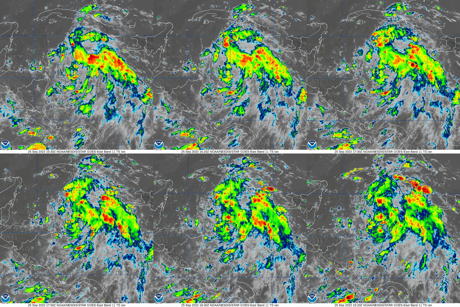
The heavier convection (rain and stuff) has increased a little since last night, but other than some clouds, it is still not fully wrapped around his center of circulation:
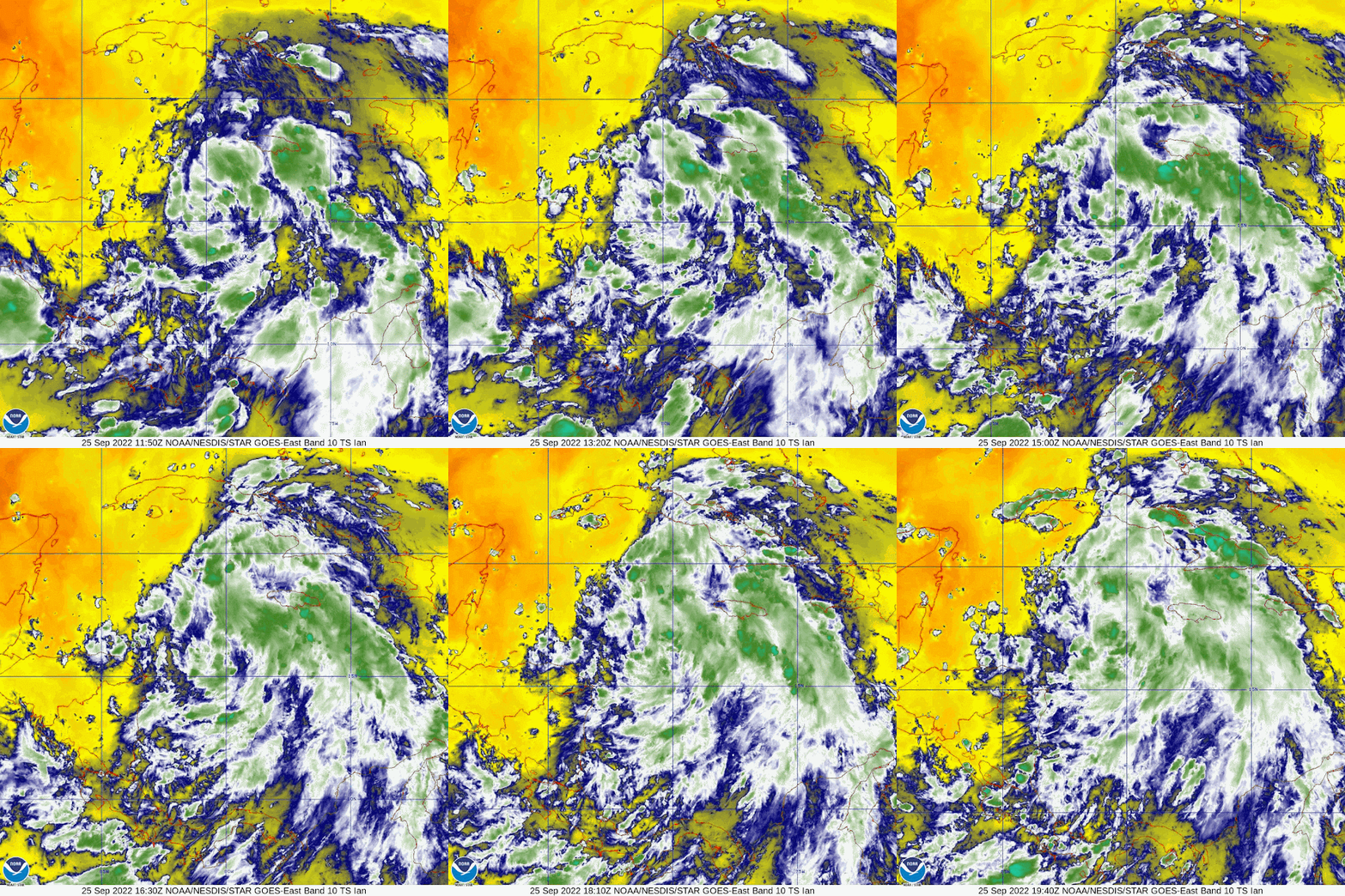
Although the sea surface temperature is warm (over 29 deg C) and water warmer than 26 deg C is in the upper 100m of the water column, it does look like there is some dry air in this system which is coming in from the northwest which is one factor keeping him in check. This is the satellite imagery of water vapor in the lower levels of the troposphere - the yellow areas are dry air.
You can see from this that the water vapor is increasing near his center of circulation, but it was dry before that increase (shown by the purple parts). So, with increasing water vapor, warm ocean waters, and almost no wind shear, he will continue to intensify some more today as forecast (although I don't think it will be as rapid as forecast because I think he is already stronger than the official forecast).
Looking ahead, his intensity depends on the track he takes:
Eastern path/less intense storm possible: If he remains to the eastern side of that cone, he will pass over land (Cuba) and then only briefly over the deep warm waters of the Loop Current/Florida Current, so he won't intensify too much and may not even become a major hurricane (cat 3 or higher).
Western path/more intense storm possible: On the other hand, if he stays on the western side of that cone of uncertainty, he may only just skim over Cuba and will spend longer over the deeper warm waters of the Loop Current which will give him a lot more energy to get more intense and he could become a major hurricane.
However, in either case, when he does reach the northern Gulf, the water temperatures there are around 28 deg C, but that warm water doesn't extend very deep into the water (across the entire northern Gulf) - only the top ~40m or so are warmer than 26 deg C. The forecast also calls for an increase in wind shear by the time Ian gets into the northern Gulf, so at the moment it is unlikely that the storm will be a major one by the time he actually makes landfall in the US.
Post-Tropical Storm Fiona
A quick note to wrap up on Post-Tropical Storm Fiona - Canada is assessing the quite extensive damage from Fiona which was because she was a merger of a tropical storm and a front, so there was a lot of energy in this storm. Not necessarily the tornadoes and crazy thunder/lighting you get in a strong hurricane, but she did bring some very strong winds because of that energy (with the highest measured wind gusts of ~111mph) which resulted in downed trees and power outages. She also had the lowest pressure for a storm reaching Canada, with a recorded low pressure of 931mb on land. Her storm surge was also substantial and washed houses out to sea - here's a tweet of one of many videos doing the rounds on the internet that shows the storm surge first hitting the coastline. I think this is one of the strongest storms Canada has seen in decades - if not a century!
More later my peeps,
J.
Blogs archived at http://jyotikastorms.blogspot.com/
DISCLAIMER:
These remarks are just what I think/see regarding tropical storms - not the opinion of any organization I represent. If you are making an evacuation decision, please heed your local emergency management and the National Hurricane Center's official forecast and local weather service announcements. This is not an official forecast. If I "run away, run away" (Monty Python), I'll let you know.


No comments:
Post a Comment