Saturday, August 31, 2019

Hurricane Dorian Gray: August 31, Update A


I have a sneaky feeling that a few million people breathed a sigh of relief today… but a few million others went ‘what the...?!?’ Hurricane Dorian Gray, ever a tricky one, is still on track for the Bahamas, but his forecast took a bit of a turn, didn’t it?

He is currently at 26.2N, 74.7W heading W at slowish 8mph. He is a pretty good looking and strong cat 4 storm with winds of 150mph (cat 4 range: 130 – 156mph). He has had a beautiful eye for most of the day:


The circulation in all levels of the troposphere is quite robust, which matches the signal of a cat 3 or 4 storm. I keep mentioning troposphere so before I go any further, let me explain the mysterious ways of our atmosphere… 

<Science Alert!> The troposphere: Our atmosphere is divided into layers – like a delicious trifle or seven-layer dip or lasagna (depending on what country you are from). In each layer the air temperature either increases with height or decreases with height. The troposphere is one of these layers. It is the lowest layer of our atmosphere and extends up from the earth (ground zero if you like) to about 15-16km in the equatorial regions, and to about 8km in the polar regions of the planet. This is the layer of the atmosphere we live and breathe in. All our 'weather' essentially occurs in the troposphere. The troposphere is defined by decreasing air temperature with increasing height. You would know this if you climbed a mountain. Or the easier option, of course, is to just look at pictures of mountains and see the snow at the top (known as the ‘Flat Florida Option’ ;-)). The top of the troposphere is called the tropopause. Strong tropical storms have clouds that reach as high as the tropopause - and in a few very strong cases, they can extend even higher into the next layer up - into the stratosphere, which is the layer of the atmosphere above the troposphere. The stratosphere is defined by air temperature increasing with height. The ozone hole is in the stratosphere. The top of the stratosphere is around 50km height and is marked by the stratopause. And the layer above that is mesosphere, where air temperature decreases with height again until the mesopause. Above that is the thermosphere, then the exosphere... and then we get to space.<End Science Alert!>

(Oooh… three Science Alerts! in three days. Aren’t you the lucky ones? ;-)).

The fact that temperatures decrease with increasing height in the troposphere gives us a clue about how strong the storm and it’s convection (rain, thunder etc.) is. The satellite imagery above is the infrared imagery and shows the cloud top temperatures. Higher cloud tops means a more turbulent atmosphere and stronger convection, but it also means colder cloud top temperatures. In the image above, the red areas correspond to very heavy rain, strong winds, a lot of thunder, tornadoes… basically everything and the kitchen sink. Orange areas are less strong – thundery weather, strong winds, heavy rain. Yellow would be strong winds and rain, green is mostly rain with some wind, and then it gets to light rain/just cloudy where we see blue and gray. 

We also see in the satellite image that he has some clouds streaming off to the west – he is actually experiencing a little wind shear which is keeping him a little in check, but unfortunately not enough for the Bahamas. As he gets closer to the islands, his convection will get disrupted, but it may not be enough and it looks they will be hit by a substantial storm tomorrow and into Monday: 


If the eye goes directly over the islands (worst case scenario for the islands), that will really help to decrease his intensity. But if it doesn’t, they will still experience a very strong storm. 

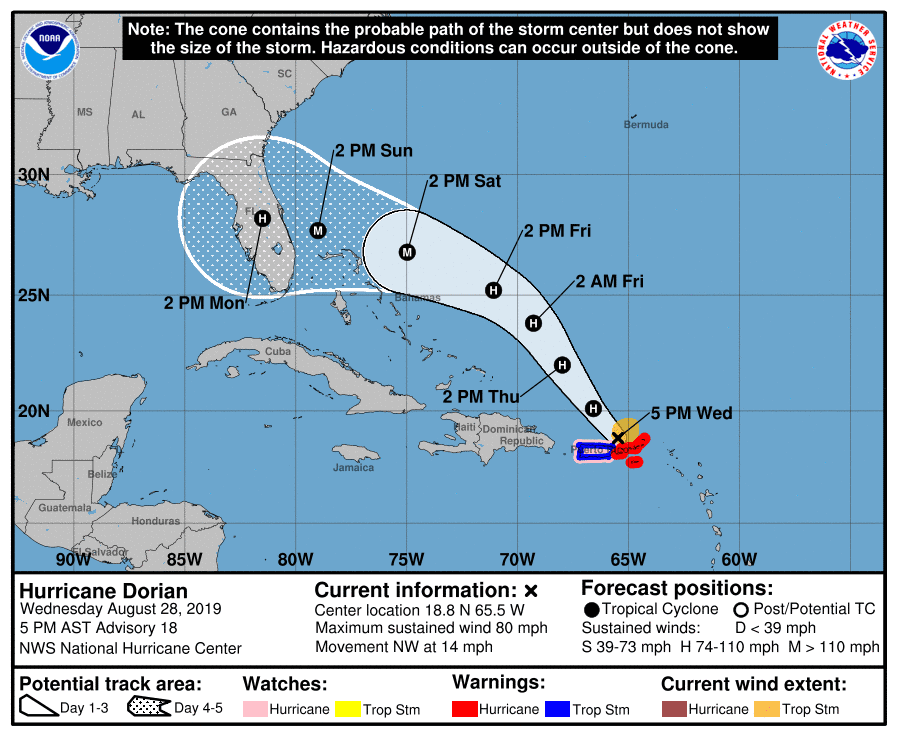
As for the track beyond Monday… well, that continues to turn to the right. I don’t have access to good enough pressure field data so I would stay on alert if you are in that cone of uncertainty. 

There are a couple of other blobs and blobettes out there, I know. But I’ll save those for a day or two.

Stay safe Bahamas!!
J.  

Twitter: jyovianstorm

--------------------------------------
DISCLAIMER:
These remarks are just what I think/see regarding tropical storms. If you are making an evacuation decision, please heed your local emergency management and the National Hurricane Center's official forecast. This is not an official forecast.
--------------------------------------


Friday, August 30, 2019

Hurricane Dorian Gray: August 30, Update A

The Picture of Hurricane Dorian Gray continues... 

Officially he is now a weak cat 3 storm with winds of 115mph (cat 3 range: 111 - 129mph), central pressure is 970mb. He's at 24.8N, 70.3W, heading NW at 10mph. 

I would agree with this cat 3 ranking. A few hours ago his eye developed and has been pretty steady since then. The circulation in the upper troposphere has improved and looks like the signal one would expect to see with such a manly hurricane. Also, we now see that he is a little more 'circular' in overall appearance as he was under some light wind shear before, but that has now vanished.

Those of you who are paying attention will notice that his forward speed has slowed down, which means we are now looking at possible landfall in Florida on Tuesday instead of overnight on Sun/Mon - a day delay (and more prep time!): 

A slower hurricane does causes issues for forecasting the track, but also for the intensity. He's heading to the northern Bahamas, now arriving there on Sun/Mon night, which is not good for those islands alas, but will stop him from intensifying as he passes over them. A couple of reasons for this are his interactions with the 'land', but also because the warm water is so shallow around the islands that he doesn't have much energy to pull from for a short period of time. You can see the area marked as the dark blue patch in this image, which shows the depth of the 26 deg C water:

(Image and data from NOAA AOML). 

See that dark blue area around the northern islands in the Bahamas (Grand Bahama and Great Abaco)? Depending on his exact path and how slowly he crosses this area, this may decrease his intensity by a category (or maybe two categories if he's slow). This would be the best case scenario - but for this he needs to move slowly. So that's something to watch out for. 

But after that, we run into a bit of trouble. He is forecast to get even slower as he crosses the Gulf Stream (which you can see as the yellow area in the figure above, where the upper 100-125m of the water column is warmer than 26 deg C), which means he will have plenty of warm water to feed off before getting to Florida, which means he will restrengthen (assuming he lost some steam over the islands). If he stalls, we have a second issue in addition to his intensification, which is that we don't know which way he will go after that (which is why the cone of uncertainty is so huge at the moment). 

<Science Alert!> Why would a storm stall? You have heard of atmospheric high pressure and low pressure, right?  Imagine them as hills and valleys in the atmosphere, except made of air. Now imagine the storm is a ball on this undulating field. If the path ahead is low pressure, it's like a downhill gradient and the ball will happily keep on rolling forward at a decent speed. If the path in front is high pressure, it's an uphill gradient and the ball (storm) will slow down (which is what we are seeing with Dorian), or maybe move in a different direction until it finds an easier path downhill. This is why the track of a storm has so many wriggles (technical jargon ;-)). 

But if the ball gets stuck in a 'dip', it is surrounded by high pressure on all sides, and it becomes difficult for the storm to move in any direction, so it will stop where it is until the pressure fields around it change (which they eventually will do). Of course, as pressure fields change, the longer range track forecast will also change, even though the storm may not have moved far. So not only do forecasters need to predict the track of the storm, but they need to predict the entire surrounding pressure field (which means predicting the entire world's atmospheric pressure field as it is all connected) and how it will change before the storm moves again and that's where computer models really kick in - these are massive undertakings. <End Science Alert!>

That's why the forecast track on days 4 and 5 gets a little wobbly.

More later my friends. Sorry Hurricane Dorian Gray isn't a good one - he's good looking though, just like Oscar Wilde predicted all those years ago! 

Ciao for now,
J.

Twitter: jyovianstorm
--------------------------------------
DISCLAIMER:
These remarks are just what I think/see regarding tropical storms. If you are making an evacuation decision, please heed your local emergency management and the National Hurricane Center's official forecast. This is not an official forecast.
--------------------------------------

Thursday, August 29, 2019

Hurricane Dorian: August 29, Update A

No point flaffing around today...  

Hurricane Dorian is still a cat 1 storm with a very small eye that is appearing intermittently (according to aircraft data - not so easy to see in the satellite imagery). Along with the circulation in all levels of the troposphere, this means his wind speed was somewhere around 90mph which means he was a little stronger as a cat 1 storm (cat 1 range: 74-95mph), but the eye hasn't been seen for a few hours so the latest official update has his winds at 85mph, central pressure 986mb. I'd say he is a little stronger, but agree that he is still a cat 1 storm. 


He will steadily get stronger because of the reasons I gave yesterday (low wind shear, sufficiently warm waters, moist air, and no land). I see that the NHC have increased his intensity forecast since yesterday, saying that he will be a major storm (a cat 3 or higher) in the next 24 hours. There are a couple of reasons that this may happen. First, he will be passing over a patch of slightly warmer water (29 deg) north of the Turks and Caicos, however the water does get shallower in his path so that will not be too much of an effect. Second, there is a low pressure front with a lot of circulation in the upper troposphere and I've seen storms intensify when they go through one of these. So, there is a possibility that he will be a cat 3 tomorrow, but I think most likely he'll be a strong cat 2/weak cat 3.

He is currently at 22.5N, 67.7W, heading NW at 13mph. How strong he gets before landfall in Florida depends on his track as he gets closer to Great Abaco and Grand Bahama. The track has been shifting slowly south, bringing him a little closer to that portion of the Bahamas (sorry Bahamians!). Those are the only pieces of 'land' that would inhibit his growth - but not by much. The major factor in intensity change between him and Florida is really the Florida Current/Gulf Stream system, which he has to cross.

<Science Alert!> The Florida Current: This is part of an ocean current system that flows from the Caribbean into the Gulf of Mexico through the Yucatan Strait, and then out of the Gulf of Mexico through the Straits of Florida, and up the east coast of the US. It leaves the US coast around North Carolina and flows across the north Atlantic to the UK. When it is in the Gulf of Mexico, it is known as the Loop Current. As it exits and flows past Florida, it becomes the Florida Current (because we like things to be named properly), and then beyond Florida it is known as the Gulf Stream. The Loop Current can extend quite far into the Gulf some years, and not so far in other years. So why is this current system important for tropical storms? This system is well known because it has the deepest warm waters (and is very fast flowing). The deep warm waters (the upper 125m can be warmer than 26 deg C) mean that tropical storms that pass over any part of this system have a jolly good (British understatement) chance of becoming stronger. <End Science Alert!>

(ooh, look at me, sneaking in a bit'o'science! It's just like the old days... ;-)).

If he is a cat 3 as he approaches the Florida Current, there is a good possibility (everything else being equal) that he will be a cat 4 at landfall as he crosses this current (but if he's a cat 2, then cat 3 is a possibility). Don't take this as definite yet - tomorrow we will know more because this all depends whether he gets to that cat 3 stage tomorrow or not.

As for his track... alas, there is HUGE uncertainty in the models which is why the entire east coast of Florida (and a tinsy bit of Georgia) is on alert (I'll rant about this at some future point - no time today!):
Remember not to focus on the center of the cone of uncertainty - the entire area is where the storm could go - at four days, that covers a range that is 155 miles long, and at 5 days out, that covers 205 miles! 

For those in west Florida, generally he will downgrade by two categories as he crosses the peninsula (unless he goes over Lake Okeechobee or the Everglades). 

As you prepare, in addition to my usual hurricane supply check list (which obviously features ice cream and wine in sufficient quantities ;-)), here's the link (thanks to Yoav R. for sharing) from the State of Florida for hurricane preparedness

Stay safe out there! Get ready!
J.

Twitter: jyovianstorm
--------------------------------------
DISCLAIMER:
These remarks are just what I think/see regarding tropical storms. If you are making an evacuation decision, please heed your local emergency management and the National Hurricane Center's official forecast. This is not an official forecast.
--------------------------------------

Wednesday, August 28, 2019

Hurricane Dorian: August 28, Update A

I was on intergalactic travel today (Earth to Planet Dragoncon)... and so of course Dorian would decide that today is a perfect day to make a run for it and becomes a Hurricane. Tsk tsk. I've had a few messages from my lovely readers so I'll jump right in... 

Hurricane Dorian
The story so far: he crossed into the Caribbean yesterday and interacted enough with St. Lucia that he wasn't a full card-carrying member of the Hurricane variety as he approached the northern Caribbean. His track did, indeed, shift to the north and east, and earlier today he passed the US Virgin Islands instead of directly crossing Puerto Rico, becoming a weak cat 1 storm (cat 1: 74 - 95 mph) as he passed by St. Thomas (hope it wasn't too bad out there my friends!).

He is currently at 18.8N, 65.5W heading NW at 14 mph. Winds are now 80mph which makes him a weak-to-mid strength storm (cat 1: 74-95mph), central pressure 997mb. 

There is circulation in all levels of the troposphere now, although it isn't very strong in the upper levels, so I agree with this intensity. Backing this is that he doesn't yet have a good eye, which is further evidence that his winds are below around 90mph. I also agree with the forecast that he will get stronger in the next couple of days for a number of reasons. First, the waters are warmer than 28 deg C, with the upper 100m being warmer than 26 deg C, which means he has enough food to get stronger. Second, there isn't much wind shear in front of him - not until he gets closer to the Bahamas. Third, there isn't any land in front of him as he heads NW. And fourth (as if we needed any more reasons!), there isn't any dry air in front of him: 


Sooo.... I have to agree with the NHC guidance that he will get stronger and may become a major hurricane (cat 3 or higher) in the next few days.  

As for the track, the current forecast has him heading NW and then turning to the west and towards Florida (in case you hadn't noticed if you live in that part of the world!): 

I would definitely get ready (as I am sure you are)! It's still 4 days out from any landfall, so a lot can change as far as the track of course. And if he crosses the Bahamas then his intensity may decrease a little. There is a possibility that his track may shift slightly more to the west/south as he gets a little further from the Caribbean, taking him closer to the southern Bahamas on Friday. 

Must run... TS Erin (very weak) will have to wait. 

More soon (maybe even later today)!
Ciao for now,
J. 


Twitter: jyovianstorm
--------------------------------------
DISCLAIMER:
These remarks are just what I think/see regarding tropical storms. If you are making an evacuation decision, please heed your local emergency management and the National Hurricane Center's official forecast. This is not an official forecast.
--------------------------------------

Tuesday, August 27, 2019

Tropical Storm Dorian and Tropical Depression Six: August 26, Update A

"The true mystery of the world is the visible, not the invisible." - The Picture of Dorian Gray. 
 
And visible today are Tropical Storm Dorian (Gray) and Tropical Depression Six (formerly known as the Atlantic Blobette)...
 
 
This satellite image of the water vapor clearly shows Tropical Storm Dorian and Tropical Depression Six. 
 
Tropical Storm Dorian (Gray)
He is at 13.2N, 60.2W, heading WNW at 13mph. He hasn't intensified much since yesterday and still has winds of 50mph, central pressure of 1005mb. He looks a little better developed than this suggests, but this is based on data from a Hurricane Hunter plane so that should be pretty solid.
 
He passed close to Barbados earlier today and is heading towards the windward islands: 
The path takes him over Puerto Rico as a weak cat 1 hurricane. I think the path may be shifted slightly to the north and east, but that track depends a lot on how strong he is once he crosses into the Caribbean.
 
The water vapor shows that there is dry air in front of him, which will inhibit his development. There is also some wind shear in the Caribbean, but it may be a little too far in front of him to make a huge impact. The water is, of course, quite toasty warm which would allow him to slowly grow. But, as I said yesterday, his intensity once he crosses into the Caribbean will depend on his exact track and whether he visits any island - so we will have to wait and see how close he gets to St. Lucia (which is the island directly in his path):


Tropical Depression Six
This one became an official Tropical Depression, which means that there is a closed circulation with winds higher than 17mph. She is officially at 31.5N, 72.2W, heading E at a very slow 3mph. Her winds are at 35mph (which may be a little high actually) and central pressure is 1010mb. She is not very well organized, and they think the center is to the north west of the mass of clouds, which means she is under a lot of wind shear with most of the clouds to the south:


 It's hard to assess the center of circulation from this night-time satellite image, but there is definitely wind shear. It looks like they will give her a name tomorrow though - in which case, this is the future Tropical Storm Erin. Her path keeps her out at sea until Thursday when she approaches Canada as Tropical Storm. 

I was going to talk about my other exciting project today... but it was a busy sort of day at work so I may have to take a rain check (because what else does one do when one talks about the weather? ;-)). 

Until the morrow!
Ciao,
 J.
Twitter: jyovianstorm
--------------------------------------
DISCLAIMER:
These remarks are just what I think/see regarding tropical storms. If you are making an evacuation decision, please heed your local emergency management and the National Hurricane Center's official forecast. This is not an official forecast.
--------------------------------------

Sunday, August 25, 2019

Tropical Storm Dorian, the Atlantic Blobette, and Hashtag: August 25, Update A

I didn't write about short-lived little Tropical Storm Chantal as she wasn't being much of a bother; just hanging out in the Atlantic with the fisheeeze last week. But today we have a few things on the palette: a bona fida Tropical Storm, a bona fida blobette, and my bona fida Award-winning film (oh yes, quite a year for a geeky scientist... read on!). 

First...

Tropical Storm Dorian

I'd like to paint a Picture of a mass of Gray swirling clouds named Dorian... too obvious? ;-) #OscarWilde

Dorian has been a blob in the Atlantic for a few days and was named yesterday. He is currently at 11.5N, 54.2W and is moving W at a pretty decent 14mph. He is a weak-to-mid-level Tropical Storm with winds of 50mph (TS range: 39-73 mph), central pressure 1003mb. His circulation is good in the lower half of the troposphere, but, unlike the Dorian Gray of legend, he isn't very good looking yet (no clear circular cloud pattern) so I agree with this TS classification. 

Here is the loop for the infrared cloud top imagery (I dub this image The Picture of Tropical Storm Dorian Gray... :-))...

There is a little wind shear from the south which we see because the clouds are extending to the north of the main convection. This shear is helping to slow his development. It also looks like he has a bit of drier air (the dark purple bits) in front of him as he heads towards the Caribbean, which will also keep him in check:

The forecast is that he will cross the Windward Islands and enter the Caribbean on Tuesday:
The water temperatures in his path are warm - over 28 deg C, with the upper ~100m of the water column being warmer than 26 degrees, which gives him enough fuel to continue to grow. But, in addition to wind shear and dry air, there is one more factor that will inhibit his growth as he crosses into the Caribbean are the islands themselves. We've seen storms fall apart if the center crosses directly over the mountainous island terrain. At the moment I agree with the intensity forecast, but his strength in the Caribbean depends very much on his path.

Atlantic Blobette
This blobette is still under development. She has a 70% chance of forming in the next 48 hours according to the NHC. Their current guess for a location is around 31N, 76W:


There is some circulation, but it's not very well formed. It does looks like it is developing so I agree that something is brewing, but I think where the official 'x marks the spot' is currently too far north - I'd say it was closer to 26N, 70W. They are planning on sending a plane in tomorrow to investigate and bring back some 'proper' data and we'll know more then

More on these storms tomorrow. I have to say thank goodness it's been a slowish storm year so far as I really needed the time! Two major 'projects' I've been working on came to a close in the last few months, both exciting and different.

Hashtag - a Short Sci-Fi Film! (when in LA...)
In case I somehow managed not to slip this into casual conversation (inconceivable!), I produced a short science fiction film in my spare spare time (as you do) called Hashtag. It stars Gigi Edgley (Farscape, Jim Henson's Creature Shop Challenge), Erryn Arkin (CSI, Home and Away), and Juliet Landau (Bosch, Buffy the Vampire Slayer, Ed Wood) as the voice of the AI assistant, T'ea. Ben Alpi (director/co-writer, and my lovely hubby... hence being involved in this project (yes, we're still married! ;-)) and I have been submitting to film festivals and I'm proud to say it has been accepted into 10 Film Festivals so far (plus a special UK premiere screening at SCI-FI Ball). Here is the trailer...


I'm also very thrilled to share that it has won TWO Awards (to date)!! Overall Best Short Film at Gen Con Film Festival in Indiana in early August, and today we found out we won Best International SciFi Short Film at New Renaissance Film Festival in London!

I know some of you have worked on this film (we had around 80 cast and crew on this) and some of you are backers (we had almost 300 backers) - congratulations to you all and Thank You! :-)

Tomorrow I'll tell you about the conclusion of the second 'project'! But today... time for a celebratory beverage all round methinks. 

Ciao for now, 
J.

Twitter: jyovianstorm
--------------------------------------
DISCLAIMER:
These remarks are just what I think/see regarding tropical storms. If you are making an evacuation decision, please heed your local emergency management and the National Hurricane Center's official forecast. This is not an official forecast.
--------------------------------------