Quite a bit going on today....
 |
| (Hitchhikers Guide to the Galaxy) |
Tropical Storm Gonzalo
His center was moved a smidge to the south since I last wrote, which is what I was seeing so that got my seal of approval. He's still moving mostly westward at a nice 14mph, and is currently officially at 9.9N, 50.6W:
The official forecast track has continued to adjust southward over the last two days, which brings it in alignment with the data. But, from the circulation (vorticity) and satellite data, I still think they have him a little too far north:
He hasn't strengthened as originally forecast, so he's still a mid-size Tropical Storm with winds of 60mph (TS range: 39-73mph), central pressure 1000mb. This is primarily, of course, because of the dry and dusty Saharan Air Layer. He's skirting the edge of the SAL, but will be heading into an even drier spot in a couple of days:
He is trying to become a hurricane, which we can see in the satellite imagery, but that SAL is keeping him in check. The NHC forecasts a hurricane by Saturday morning, but with that SAL directly in his path that may not happen.
Tropical Storm Hanna
As expected our blobette was named, but she's officially barely a Tropical Storm with winds of 40mph, central pressure of 1002mb (TS range: 39-73mph). However, she has a much better structure than TS Gonzalo, as we can see in the satellite imagery. This one is the geocolor image - it's pretty cool because you can see the lights at night, although we're really supposed to be looking at the storm, but ooh, the pretty lights... ;-):
This one shows the cloud top temperatures and gives us an indication of the convection:
(The Science and Technical Alerts in this post tells you all about the significance of the cloud tops: http://jyotikastorms.blogspot.com/2020/06/ts-cristobal-june-3-update-a.html).
I think they may be a little off on the intensity forecast for Hanna. The forecast currently keeps her as a TS until landfall on Saturday, with winds no higher than 65mph. I think she may get a bit stronger, perhaps a cat 1 on landfall - there is very little wind shear, the sea surface temperatures are 29-30 deg C, and although water warmer than 26 deg C is only in the upper 75m, she is moving a little slowly.
She's currently at 26.2N, 91.4W, heading WNW at 7mph:
I'm going with the NHC track forecast on this as I mentioned yesterday.
To be honest, this one should be easy to forecast for the NHC... I see that the show is already on the telly:
Hurricane Douglas
(did you really think that the 'it must be Thursday' Douglas Adams reference was a coincidence? ;-))
I had a special request from Hawaii... Hurricane Douglas is currently a major hurricane - a weak cat 4 storm in the eastern Pacific, with winds of 130 mph (cat 4 range: 130-156mph), and a very low central pressure of 954mb. He'll be arriving at the beautiful Hawaiian islands on Sunday...
He is currently at 14.9N, 138.8W, heading WNW at a brisk 18mph. I must say, he is certainly a handsome storm with a very clear eye (over 17 miles in diameter!) and a lovely outflow:
His circulation is strong throughout the troposphere and there is very little wind shear between him and the Big Island. The sea surface temperature is around 26-27 deg C, so just enough to feed him, with the upper 75 m or so being 26 deg C or warmer. However, he will soon move over cooler waters so I agree with the NHC forecast that by Friday he will weaken a bit and will be closer to a cat 1 as he approaches the Big Island. His growth will also be inhibited a little by drier air to his north, which we can see in this water vapor image:
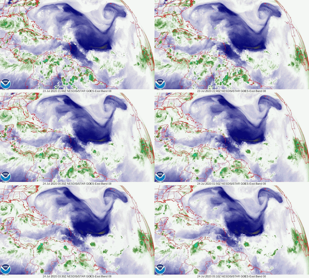
For comparison, you can see the dry air from the Saharan Air Layer near TS Gonzalo:
(the SAL is dust which is super-drying anyway, but the yellow streak is very dry air)
And just for fun, the more humid environment around TS Hanna:
Phew. Time for a nice nap now. More tomorrow.
Toodle pip!
J.
Twitter: jyovianstorm
--------------------------------------
DISCLAIMER:
These remarks are just what I think/see regarding tropical storms - not the opinion of any organization I represent. If you are making an evacuation decision, please heed your local emergency management and the National Hurricane Center's official forecast and local weather service announcements. This is not an official forecast. If I "run away, run away" (Monty Python), I'll let you know.
--------------------------------------


No comments:
Post a Comment