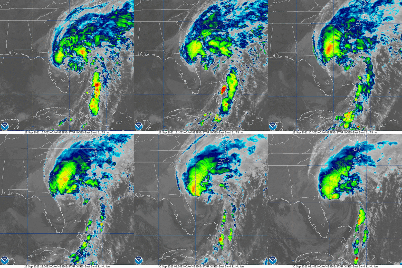
Phew... this was a two glasses of wine evening! The good news is that the Tampa Bay area got off fairly lightly, but I'm sure you have all seen the destruction in the Ft. Myers area and other parts of the state with many areas still flooded, almost 2 million without power, and 14 deaths so far in Florida. This will be the last time we have a Hurricane Ian on the roster and in 6 years, it will be another name for 'I'. But, alas, Ian isn't quite over yet...
He is now officially a mid-intensity cat 1 storm with winds of 85mph, central pressure 984mb (cat 1 range: 74-95mph):
His convection is not very strong though - in fact, what little we see in the satellite imagery above is because he is over the warm (and deep warm) waters of the Gulf Stream. This is an area where storms usually get stronger but there are three reasons he doesn't look as strong as we would expect. First, there is the wind shear which he's been experiencing for the last couple of days. This has resulted in his upper level circulation being offset from the lower level circulation so he is not very well vertically aligned. Second, there is an immense amount of dry air. The satellite imagery below is the water vapor from the mid-levels of the troposphere and the yellow areas are dry air:
And third, although he is officially a hurricane on the books, he is actually merging with a front which is really where he is getting that extra boost of energy (instead of from the ocean, which is where he would get it if he were truly a tropical storm). The lowest levels of the troposphere are already looking more like a front - the upper levels are still showing tropical storm circulation. This merging of a tropical storm and a front is what happened with Post-Tropical Storm Fiona as she reached Canada last week.
For a hot minute before leaving Florida (just north of Cape Canaveral near New Smyrna Beach) he was officially downgraded to a Tropical Storm but promptly went back up to hurricane strength. I am not sure he really lost that hurricane intensity because his circulation remained fairly strong throughout the troposphere - even in the higher levels - which means he had a relatively good storm structure of the sort we see in hurricanes.
He might get a little stronger before reaching land which looks like it will be the South Carolina coast (near the North Carolina border) tomorrow:
He is currently at 30.2N, 79.3W, heading NNE at 10mph. As expected, the track has shifted eastward all day and is now getting closer to a good estimate for landfall - better than this time yesterday... landfall may be near Myrtle Beach, although, if you are in Wilmington, NC, you may want to be ready for a bit of a breeze in addition to the rain you will get as I think he still has room to shift to the east.
The winds will be pushing water onto the coast north of the center, and off the coast south of the center. I would suggest you have a look at the sea level sensors along the coasts of Georgia and South Carolina, however that won't take long because it looks like there is only one in Georgia - in Savannah - and two in South Carolina - one in Charleston and one near Myrtle Beach. Water at Fernandina Beach in Florida is at around 2ft above normal, and Savannah is 1 ft above normal at the moment.
Tomorrow, I hope I'll be saying that Hurricane Ian is over! In the meantime, for those of you in the Carolinas - listen to your emergency managers and be safe.
Ciao,
J.
Blogs archived at http://jyotikastorms.blogspot.com/
DISCLAIMER:
These remarks are just what I think/see regarding tropical storms - not the opinion of any organization I represent. If you are making an evacuation decision, please heed your local emergency management and the National Hurricane Center's official forecast and local weather service announcements. This is not an official forecast. If I "run away, run away" (Monty Python), I'll let you know.


No comments:
Post a Comment