Friday, September 13, 2013

Tropical Storms Humberto and Ingrid: September 13, Update A

It’s Friday the 13th!... and what a crazy long week this was! Definitely time for a second glass of wine. And possibly a bit of fried banana cheesecake with vanilla ice cream. Yum yum! :-) I‘m going to ignore the (now) low pressure formerly known as Gabrielle because I can (she’s bringing some splotches of rain to Canada) and we’ll move straight onto the other two. It seems like the only sensible thing to do.

Tropical Storm Humberto

He took a rapid nose-dive today and is now a weak Tropical Storm with winds of 45mph, estimated central pressure 999mb (TS range: 39-73mph). He is at 24.8N, 33.0W, heading on the forecasted track of W at 9mph. It looks like the wind shear, cooler sea surface temperatures (24 deg C) and dry air all took their toll. You can just about see him in this infrared satellite image of the Atlantic:

There is no convection to speak of (nothing in the oranges or reds)! He still does have circulation in the lower half of the troposphere but nothing in the upper troposphere anymore, which is what we expect for a Tropical Storm. And as you all know about vorticity (circulation) because you all read and memorized my entry yesterday (didn’t you? ;-)), you can see his circulation for yourself! Here is the vorticity ‘map’ (University of Wisconsin) from the upper level of the troposphere:

Comparing this to the plot from yesterday (when he was a hurricane):

you can see the signal that was in the upper levels of the troposphere has vanished. However, as I said, he still does have circulation in the lower half of the troposphere as you can see in the vorticity from the middle of the troposphere:

Given the circulation, but no convection, I think even 45mph may be a little over-estimate. The NHC have him strengthening and becoming a hurricane again next Wednesday. I don’t see this happening – the waters will remain cool, there is still dry air and wind shear. I don’t know if he will survive much beyond tomorrow actually.        

Tropical Storm Ingrid

This one is a little tricky! I see the Tropical Storm designation of Ingrid as more of a conflict between people underestimating nature and scientific accuracy.  Officially she is at 19.2N, 95.2W, and is stationary. Her winds are officially at 60mph (central pressure 993mb), which makes her a mid-intensity storm. She may have been a Tropical Storm for a few hours today, but I am not fully convinced and she’s definitely not one now. Today she has been partly over warm water and that is generating a lot of convection, including some strong thunderstorms (which we see in the summer months in the tropics anyway) with strong winds. She also does have some circulation, but it hasn’t really been as fully isolated as we see in tropical storms – e.g. Humberto. As you can see from the vorticity in the middle of the troposphere (above), she is now well and truly part of a line of vorticity that extends into the Pacific, so she really isn’t a tropical storm in structure at all!

The reason I say this is a tricky one is because there is certainly a lot of strong convection (thundery weather) because of the warm water, so I’m sure there are areas of strong wind. Keeping her at the Tropical Storm designation is probably for the best in terms of alerting people in Mexico to the stormy weather, however speaking with my science hat on, I would have to disagree with this designation.

That’s it for now!
Toodle pip!
J.

Blogs archived at http://jyotikastorms.blogspot.com/
Twitter @JyovianStorm

-------------------------------
DISCLAIMER: These remarks are just what I think/see regarding tropical storms - not the opinion of any organization I represent. If you are making an evacuation decision, please heed your local emergency management and the National Hurricane Center's official forecast and the National Weather Service announcements. This is not an official forecast. If I "run away, run away" (Monty Python), I'll let you know.
-----------------------------

Thursday, September 12, 2013

Tropical Storm Gabrielle, Hurricane Humberto, Tropical Depression 10, and the sound of interstellar space!: September 12, Update A

Bravo to all those who worked on Voyager. What an awesome achievement! As a tribute, this entry will be out of this solar system and we will boldly go where no spacecraft has gone before. By the way, have you heard the sound of interstellar space yet? If not, listen here: http://www.youtube.com/watch?v=LIAZWb9_si4&feature=youtu.be. I think the translation so far is: “People of Earth, your attention, please. This is Prostetnic Vogon Jeltz of the Galactic Hyperspace Planning Council.” Great. The first interstellar contact and it’s a planning council?? Really? Hmm… I wonder what they want? ;-) (HGTTG)

Tropical Storm Gabrielle

Meanwhile, here on planet Earth we have Hurricane Humberto, Tropical Storm Gabrielle, and Tropical Depression 10. You can see all three of them in this IR satellite image of the Atlantic:

What do you mean you can’t see three? Look again: Humberto is on the left, Gabrielle is close to the northern edge of the image, and TD10 is over Mexico. Still can’t see Tropical Storm Gabrielle? Hmm. Apparently the NHC can see her quite clearly. Well let’s look at the circulation shall we? Surely she must have as much, if not more, circulation than a Tropical Depression?

<Science Alert!> As I mentioned a couple of months ago, the troposphere is the lowest level of our atmosphere (http://jyotikastorms.blogspot.com/2013/06/gulf-of-mexico-blobette-june-4-update-a.html). Any type of stormy weather has a defined vorticity (circulation) signal in the troposphere. Low pressure fronts look different compared to tropical storms. You can tell how strong a tropical storm is depending on how strong the vorticity is, and how high into the troposphere that signal can be seen. A Tropical Storm ALWAYS has a vorticity signal that reaches the middle of the troposphere (around 500mb) because this indicates that there is some deep convection (big thundery clouds). <End Science Alert!>

This is an image that represents the vorticity (circulation) in the troposphere (from the University of Wisconsin):

These plots are a little tricky to interpret so don’t think that all red patches are tropical storms, because they aren’t. But you can easily see Humberto on the left. A nice, strong round signal – pretty strong middle-troposphere circulation which is what you would expect for a Hurricane. There’s TD10 just hanging onto the southern Gulf of Mexico – not as well defined as Humberto and not a contained blob, so really not a Tropical Storm, but there is a bit of red so there is something there. But Gabrielle!! <Rant Alert!!> It’s blue!! BLUE!! That means there is NO deep convection in this storm… there is no way this is a Tropical Storm!! I can’t believe someone thought it was and renamed it!! NO convection, NO circulation!! What were they thinking?!?! In that case, we have stronger ‘Tropical Storms’ over Florida on an almost daily basis!! Oh, maybe those clouds in the middle of the Atlantic should have names too while we’re at it! Wow!!.....!!!!!!!!!!!!!!!!!!!!!! <End Rant!>

She’s officially supposedly at 35.1N, 67.7W, moving NNE at 10mph, winds are 40mph (very weak), central pressure 1008mb.

And that’s all I have to say about Gabrielle. Harumph. And ner.   

Hurricane Humberto

As badly mis-diagnosed as Gabrielle is, the NHC are on track with Humberto. Not only does he have convection (see satellite image above) and circulation in the middle of the troposphere as you’ve seen, but he also has a signal in the upper troposphere:

Although the dry air and wind shear is taking its toll today, the NHC estimate his wind speed to be about 80mph, central pressure 984mb. This makes him a weak-to-mid-strength cat 1 (range: 74-95mph). He is at 23.4N, 29.7W, heading NNW at 12mph. All this looks groovy to me. No rants required. I agree with the NHC forecast track of continued northward movement and the gradual turn to a more westward movement in 24 hours. I also agree with a gradual weakening, and it is quite possible that he’ll be a very weak cat 1 or a very strong Tropical Storm by this time tomorrow.

Tropical Depression 10

Again, you’ve seen that this blobette has some circulation in the middle troposphere, but it doesn’t have that well-contained area of vorticity that we see with a storm, which means it doesn’t quite have to right structure to be a tropical storm yet. She is also interacting with land and has some wind shear, so I’m not sure it will get to tropical storm status unless it moves farther into the Gulf. There is certainly a large area of convection, but that is because she is interacting with some very warm waters – the sea surface temperatures in the Gulf are over 28 deg C, with water warmer than 26.5 deg C in the upper 75-100m in some parts.   

I’ll be back again with more on some of these storms tomorrow. In the meantime, I see there has been some flooding in Colorado… from fires to floods all in one year!! Stay safe out there my peeps!

Night!
J.

Blogs archived at http://jyotikastorms.blogspot.com/
Twitter @JyovianStorm

-------------------------------
DISCLAIMER: These remarks are just what I think/see regarding tropical storms - not the opinion of any organization I represent. If you are making an evacuation decision, please heed your local emergency management and the National Hurricane Center's official forecast and the National Weather Service announcements. This is not an official forecast. If I "run away, run away" (Monty Python), I'll let you know.
-----------------------------

Wednesday, September 11, 2013

Tropical Depression Gabrielle, Hurricane Humberto, and a p.s. about the potential Gulf Blob: September 11, Update A

Tiring meeting and travel day today so this will be short - well, shorter than yesterday anyway! (I can hear you cheering from here you know! ;-)).

Tropical Depression Gabrielle

She is now a Tropical Depression with winds of 35mph, central pressure 1010mb. She is at 33.0N, 67.0W, meandering generally WNW at 6mph (obviously she’d had one too many Dark & Stormys as she went past Bermuda!). Speaking of Bermuda, I missed another report from the island yesterday from Roydon T., who also sent a couple of lovely photos taken yesterday at around 5.30pm of Devonshire Bay on the south side of Bermuda:

It looks lovely and dramatic and reminds me of the waters off Devonshire, UK (where I used to live) on a nice blustery day. J Thanks for the lovely pics Roydon! (and thanks to Helene M. for helping to get his message through).

As for Gabrielle, she has some circulation in the lowest section of the troposphere, but nothing much in the middle level anymore. As for convection, looking at this IR satellite image, I’d say you would get more by having a 1 minute shower at home!

The NHC forecast keeps her as a Tropical Depression for the next 24 hours, and then they say she will try (for the third time!) to be a Tropical Storm on Friday as she gets to Newfoundland. Hmm. I’m not sure about this scenario. She is looking rather wimpy at the moment, and by then she’ll be over cooler waters (25 deg C or less). Our other on-the-ground reporter, Steve B. sent a message at 8.17am: Heavy drizzle. Little wind. I think we can kiss this baby goodbye. Which is precisely what I plan on doing… this is my last entry on Gabrielle (unless she really does try again... I suppose).

Hurricane Humberto

Hello Hurricane Humberto! Phew. We got one in the bag! ;-)

He is currently at 19.1N, 29.0W, heading N at 13mph. I agree with this and also with the NHC official approximate track forecast for the next couple of days in which he continues north and then begins to turn towards the west again as the high pressure builds up again to the north.

Winds are officially 85mph, central pressure is 982mb. This makes him a mid-strength cat 1 storm (cat 1 range: 74-95mph). His circulation is still good throughout the entire troposphere, so I agree with his hurricane designation. I actually also agree with their estimate of intensity for now! Here’s a lovely infrared satellite image of the Atlantic in which you can see our hefty Humberto (although he’s not as hefty as he could be because of bits of dry air):

All this being agreeable… I must be tired!! ;-) Best call it a night (mostly because it is night, so it would be a bit silly to call it day). More tomorrow, of course.

Adieu!
J.

p.s. Potential Gulf Blobette: You can also see the newest blobette everyone is watching in the image of the Atlantic – it’s that broad area of not very well organized convection over the Yucatan. The circulation isn’t much to talk about either (yet). Next name will be Ingrid if she develops. I’ll have a proper look tomorrow.   

Blogs archived at http://jyotikastorms.blogspot.com/
Twitter @JyovianStorm

-------------------------------
DISCLAIMER: These remarks are just what I think/see regarding tropical storms - not the opinion of any organization I represent. If you are making an evacuation decision, please heed your local emergency management and the National Hurricane Center's official forecast and the National Weather Service announcements. This is not an official forecast. If I "run away, run away" (Monty Python), I'll let you know.
-----------------------------

Tuesday, September 10, 2013

Tropical Storms Gabrielle and Humberto: September 10, Update B

Not much time for dilly dallying with two pesky storms out and about, so I’ll jump straight to the business at hand…

Tropical Storm Gabrielle

Officially she is currently at 32.0N, 65.0W, heading N at 8mph. Winds are 60mph, central pressure is 1004mb. With winds of 60mph, this makes her a medium intensity storm (TS range: 39-73mph). She is passing pretty much over Bermuda...

… that poor little island, right in the middle of the circle known as Gabrielle. The same island that the NHC wrote about at 8pm AST: “...TROPICAL STORM CONDITIONS OCCURRING ON BERMUDA AS GABRIELLE APPROACHES...” and at 11pm AST said: ...GABRIELLE SLOWS AS IT NEARS BERMUDA... TROPICAL STORM CONDITIONS TO CONTINUE THROUGH WEDNESDAY MORNING... “.

Awww. <insert that screechy sound of a record scratching to a halt> Wait! Are they referring to this little island that experienced, at the most, a few relatively light rain showers at 6pm AST and that, by 11pm AST, had hardly any rain at all?

Or maybe they are talking about the wind speeds on Bermuda? Those strong sustained winds… that barely reached 40mph according to ACTUAL OBSERVATIONS on the island (gusts were stronger of course, but that’s not a sign of a tropical storm):

Or maybe it’s the island from which I received numerous weather reports throughout the day from our fabulous and diligent on-the-ground reporter, Steven B.?

11:52am: I’ll write to you about the storm tonight. It’s breezy and overcast but very little rain yet.
3:47pm: Still not raining and the wind has abated somewhat.  Hardly storm of the century stuff.
8:32pm: Well it’s starting to rain. Not heavily and the strong winds (25-30 knots) are blowing the rain away. High winds. Making a lot of noise at the tree tops but not much below.
9:09pm: Nothing here J, just a bit of rain and wind.  You wouldn’t worry too much if you left your raincoat at home.
9:49pm: Going to bed mate. No wind no rain

Not really a compelling case for ‘tropical storm conditions’ on Bermuda, is it?

I think she is barely a tropical storm now. There is some convection and strong circulation, but really only in the very lowest levels of the troposphere – even the structure in the middle of the troposphere is more like a front than a tropical storm. She is experiencing strong wind shear (and is heading into stronger wind shear) which is pulling her apart. Sea surface water temperatures are around 27 deg C. Definitely warm enough to keep her going for a little longer, but the warm water is in a very shallow layer near the surface – maybe the upper 10m – so nothing to make her get any stronger.

More tomorrow on the continuing saga of this poor misunderstood storm. Now for the next one…

Tropical Storm Humberto

Officially he is currently at 15.4N, 28.4W, heading NW at 7mph. Winds are 70mph, central pressure estimated to be 995mb.

Well I reckon the NHC missed the hurricane boat on this one! Just imagine if they had been on board, they could have checked ‘hurricane’ off their 2013 to-do list! I really think Humberto was a hurricane yesterday evening. I also wonder if the NHC were thinking about that this morning. From their 11am advisory:

“SATELLITE IMAGES INDICATE THAT HUMBERTO HAS STOPPED INTENSIFYING... AT LEAST FOR THE MOMENT.  RECENT MICROWAVE DATA SHOWED THAT THE STORM HAD A SMALL MICROWAVE EYE OVERNIGHT...BUT THAT FEATURE HAS SINCE DISSOLVED AND HAS BEEN REPLACED BY A LARGER BUT BROKEN INNER BAND OF CONVECTION.  IN SOME SENSE...THIS SUGGESTS AN EYEWALL REPLACEMENT...EXCEPT THAT HUMBERTO IS STILL A TROPICAL STORM.”

An eye? An eyewall replacement? Walks like a Hurricane, sounds like a Hurricane, had the circulation signal throughout the troposphere of a Hurricane, had the convection of a Hurricane. Must be a Tropical Storm. Sigh.

And of course, as their luck would have it, today he encountered some dry air which really inhibited his development so NOW he really is a Tropical Storm!

He did remain on a little more westward track, making a move to the northwest quite late in the day today. However, this is still more-or-less within the cone so I'm good with that track. I also agree with the northward motion for now because the high pressure in front of him and to his north has dissipated. I’ll go with the official track for the next two days... assuming he survives…

From this satellite image of water vapor, we see that as he moves north he runs into a little problem that we in the business like to call ‘dry air’. We saw the effect of this today in slowing his development and decreasing his convection. We’ll see how he fares but I wouldn’t be overly surprised if the NHC decide to cross the barrier and upgrade him to hurricane tomorrow – the circulation is still pretty good throughout the troposphere, although it is a little less defined in the lower troposphere compared to yesterday.  

That’s all for today. What a lark. Goodness me.  I’ll be back for more giggles (maybe even some from Bermuda) tomorrow.

Toodle pip!
J.

Blogs archived at http://jyotikastorms.blogspot.com/
Twitter @JyovianStorm

-------------------------------
DISCLAIMER: These remarks are just what I think/see regarding tropical storms - not the opinion of any organization I represent. If you are making an evacuation decision, please heed your local emergency management and the National Hurricane Center's official forecast and the National Weather Service announcements. This is not an official forecast. If I "run away, run away" (Monty Python), I'll let you know.
-----------------------------

Tropical Storm Gabrielle: September 10, Update A

Just a quick update for the newly re-formed TS Gabrielle, who apparently found some lip-gloss overnight and is now planning to party in Bermuda tonight. She is pretty weak as far as winds go, but I do agree with the TS upgrade because the circulation is now looking good for the lower half of the troposphere (nothing in the upper troposphere so not a hurricane).

Although sea surface temperatures are warm (27 deg C), only the upper ~20m are warmer than 26.5C (so it’s pretty shallow warm water) and it looks like she is being impacted by wind shear. Her center is definitely southwest of the convection, and her clouds are skewed in a southwest/northeast direction as you can see in this visible satellite:

Just in (noon, EST) from Steven B. on Bermuda: “It’s breezy and overcast but very little rain yet.” It won’t be a big wind event on Bermuda, mostly rainy. Time to brush out the cobwebs from your wellie boots!

More later (on Gabrielle and Humberto).
Ciao for now,
J.

Blogs archived at http://jyotikastorms.blogspot.com/
Twitter @JyovianStorm

-------------------------------
DISCLAIMER: These remarks are just what I think/see regarding tropical storms - not the opinion of any organization I represent. If you are making an evacuation decision, please heed your local emergency management and the National Hurricane Center's official forecast and the National Weather Service announcements. This is not an official forecast. If I "run away, run away" (Monty Python), I'll let you know.
-----------------------------

Tropical Storm Humberto: September 9, Update A

Hey hey hey… it looks like we have our first hurricane of the season! Although the NHC still have him as a Tropical Storm with winds of 60mph (TS range: 39-73mph), Humberto’s circulation is very strong in the lower half of the troposphere and he is the first storm this season (that I recall) that even has circulation in the upper troposphere – enough to classify him as a very weak cat 1 storm (cat 1 range: 74-95mph). I’d estimate his winds to be in the 75-80mph range already (but definitely not yet as high as 90mph).

He also has very strong convection in the center, as you can see in this infrared satellite image:

He is currently at around 13.9N, 25.9W, heading WNW at 10mph. Central pressure is 1000mb.

There is a little wind shear but not a lot and it doesn’t look like it will pick up tomorrow either. He is moving over waters with sea surface temperatures around 28-30 deg C - definitely warm enough to keep him going. I think he will continue to intensify – even the air around him is full of water vapor, and not that dry dusty stuff that was inhibiting storms earlier this season (which is, by the way, one of the reasons why they didn’t form (there are a couple of others, as I’ve mentioned throughout this season)…)

As for track, to me it looks like he will continue generally westward for now, although not at a very quick pace because there is an area of high pressure in front of him. The official track takes him to the north almost immediately and by this time tomorrow he will be heading almost due north:

Since the last half of last year I think the NHC have generally had a pretty good assessment of the track within 2 days (with very few exceptions).  For me it is a little tricky to tell where he will go because of this high pressure, so I’m not yet convinced that this is the track he will take: I think he may head westward for a little longer.

I definitely do see an alliterative future for Humberto! J

I’ll be back tomorrow!
Night night!
J.

(p.s. I’m watching that blobette in the Atlantic too… the remains of Gabrielle… she doesn’t have a very good structure at the moment, even though she’s a bit on the cloudy side of the er cloud spectrum ;-) ).  

Blogs archived at http://jyotikastorms.blogspot.com/
Twitter @JyovianStorm

-------------------------------
DISCLAIMER: These remarks are just what I think/see regarding tropical storms - not the opinion of any organization I represent. If you are making an evacuation decision, please heed your local emergency management and the National Hurricane Center's official forecast and the National Weather Service announcements. This is not an official forecast. If I "run away, run away" (Monty Python), I'll let you know.
-----------------------------

Thursday, September 05, 2013

Tropical Low Gabrielle: September 5, Update A

Well that was a complete waste of a name! It looks like “Tropical Storm” Gabrielle didn’t quite separate from her Atlantic blobby brother, so she was downgraded to a Tropical Depression about 12 hours after she was named, and that 12 hours is only because they named her too soon and were making sure she really didn’t develop. I don’t think she ever really achieved Tropical Storm status!   

<Editorial Rant Alert!> Over the last few days I’ve heard a lot about the gloriously inactive hurricane season we are having. Although the season isn’t over, I am a bit miffed (British understatement) at those who said with such certainty that this would be an above active season, and are now scratching their heads, wondering why they don’t know everything. I’ve said this for years, but I’m not above boring you all with a broken record (don’t you love these really old phrases ;-)): making those stupid number predictions at the beginning of a season when you don’t fully understand what is going on is just asking everyone to doubt your knowledge! (Psst, in case you need a clue… the full impact of the ocean and dry Saharan air are still being overlooked). As Mark Twain said: “It's better to keep your mouth shut and appear stupid than open it and remove all doubt.” (says she whilst opening her mouth! ;-)) If the financial experts went around saying that market stocks would crash this season, but they didn’t (or vice versa), would you believe them and invest next season? If we are to meet the lower end of those forecasts, we would have to have a named hurricane almost every week from now until the end of the season! It’s not impossible of course, and we may even have some major hurricanes, but it really is time to stop the quite meaningless number games. <End Editorial Rant Alert!>

Back to this “Don’t-call-me-Gabrielle” Tropical Low… she was last officially seen at 19N, 68.5W, heading NNW at 9mph. Central pressure was 1010mb, winds were 30mph. I don’t agree. From this image, does it look like there is anything like a center near 19N, 68.5W?

Nope. She didn’t move much earlier today, and then decided to head more northward, over Puerto Rico. She is just a rain event really. I have a few reports today (merged into one) from our great on-the-ground reporter, Tom, from St. Thomas:

‘Up until last night the rain showers were gentle and manageable, no wind since Sunday however. Best part of this system has been the last two days driving down the temp as the dry hot air curtailing and stalling the system must have passed through. It has been ungodly hot for weeks here and finally some relief...  yea we lucked out with this system...getting our cisterns full, gardens watered and no environmental damage. If you ever have to rescue us with a boat, load it with that wine you like so much!’

And the last one, an hour ago:

“You might want to get ready on that boat, the system is drifting to the east over us and raining like cats and dogs with no relief for a few hours at best.”

Stay afloat out there!
I think this will be my last word on Gabrielle unless she makes a return!

Toodles until the next one (Humberto)…
J.

Blogs archived at http://jyotikastorms.blogspot.com/
Twitter @JyovianStorm

-------------------------------
DISCLAIMER: These remarks are just what I think/see regarding tropical storms - not the opinion of any organization I represent. If you are making an evacuation decision, please heed your local emergency management and the National Hurricane Center's official forecast and the National Weather Service announcements. This is not an official forecast. If I "run away, run away" (Monty Python), I'll let you know.
-----------------------------

Wednesday, September 04, 2013

Tropical Storm Gabrielle: September 4, Update A

I guess the halcyon days of the hurricane season are over! We have Tropical Storm Gabrielle out there, swirling away in the northeast Caribbean. Although I’ve been on another planet (let’s just call it ‘Atlanta’ to protect the innocent) for the last few days, I have been monitoring the Atlantic with my super ‘They Live’ glasses. (By the way, I *just* saw this classic movie… where have I been? My eyes have been opened! ;-)).

Over the last few days, TS Gabrielle had a conjoined twin, the blob in the Atlantic, just outside the Caribbean (the yellow part):

Together, these Wonder Twins, have been creating a lot of convection over the northeastern Antilles, but that’s because these blobs have been hanging out over some rather warm water. If you look at the infra-red satellite image, it looks like there is more going on with the Atlantic blob – very strong thunderstorms and all that jazz:

However, you should never judge a book by its cover, e.g.:

(!!!! Although I do secretly think this is rather funny! ;-))

The circulation has slowly been improving since yesterday and now we know who the dominant twin is… the Caribbean wins! Although the circulation is still pretty good in both of these at the lowest level of the troposphere, as you move up in the troposphere, the circulation for TS Gabrielle is much better than her twin. I think she is actually still a Tropical Depression, but the NHC have moved ahead with upgrading her. Strictly speaking, she will be a fully-fledged TS once she separates in the lowest level (by tomorrow I reckon), but we’ve not had anything much going on for such a long time (days and days), that we may as well charge ahead… and at least this sets up the correct warnings and procedures for a Tropical Storm!

Officially, Gabrielle is currently located at 17N, 66.6W (uh-oh, 666 huh? ;-)) and she’s moving NW at a stately 8mph. She’s very weak with winds of 40mph (TS range: 39-73mph), central pressure 1008mb.

The track forecast has her moving northwest, over the eastern tip of the Dominican Republic tomorrow evening. I’m not sure yet that this is quite how things will work out, but it’s difficult to say because she really is quite weak. There is a good possibility that she may not clip the DR, but may head a little more northward, over Puerto Rico and out into the Atlantic. However, there is also a chance that she will slow down and get stuck in that region for a little longer than expected. I don’t have enough data to make a good assessment on this. I can say though that she, with a little help from her louder but more disorganized twin, will be bringing rain, followed by a splash of rain, to those Caribbean islands!

I’ll be back tomorrow with more. But in the meantime, here are a couple of lines from a 17th century poet, Michael Drayton, with a very early use of that lovely word, ‘halcyon’, (about 400 years ago):
There came the halcyon, whom the sea obeys
When she her nest upon the water lays.

Ciao!
J.

Blogs archived at http://jyotikastorms.blogspot.com/
Twitter @JyovianStorm

-------------------------------
DISCLAIMER: These remarks are just what I think/see regarding tropical storms - not the opinion of any organization I represent. If you are making an evacuation decision, please heed your local emergency management and the National Hurricane Center's official forecast and the National Weather Service announcements. This is not an official forecast. If I "run away, run away" (Monty Python), I'll let you know.
-----------------------------

Monday, August 26, 2013

Ex-Tropical Depression Fernand: August 26, Update A

Warning: do not read or discuss this if you are in proximity to any 5-year olds with access to the Mamma Mia soundtrack unless you really really really like ABBA! ;-)

Tropical Storm Fernand(o) behaved as expected… the NHC named him at 6.45pm CDT and by 11.45pm CDT they said he had made landfall about 40km NNW of Veracruz, Mexico. Estimated winds were 50mph at landfall, which means he officially went from a no-name Tropical Depression to a mid-strength storm in 5 hours, whilst interacting with land… ha, I don’t think so! Anyhoo, he is now officially ‘dissipated’ (too much tequila will do that to anyone! ;-)).  A very short lived Tropical Storm, but I still got my ABBA post in (heeheehee ß evil laughter).

How many ABBA song titles did you spot in yesterday's masterpiece? The answer is 18 (I think)…

1. Slipping Through My Fingers
2. Does Your Mother Know?
3. Another Town, Another Train
4. Arrival
5. I do, I do, I do, I do, I do
6. If It Wasn’t For The Nights
7. I Have A Dream (I think that line has already been taken)
8. Sitting In The Palmtree
9. When All Is Said And Done
10. The Name Of The Game
11. Watch Out
12. On And On And On (a bit like these ABBA songs)
13. Knowing Me, Knowing You
14. The Way Old Friends Do
15. So Long (yes, this list certainly is!)
16. Move On
17. Hasta Manana
18. Fernando (of course! ;-)).

Now to play ABBA Gold…

… again. J

This dancing queen will be back when the next blobette (Gabrielle) makes an appearance.

Toodle pip!
J.

Blogs archived at http://jyotikastorms.blogspot.com/
Twitter @JyovianStorm

-------------------------------
DISCLAIMER: These remarks are just what I think/see regarding tropical storms - not the opinion of any organization I represent. If you are making an evacuation decision, please heed your local emergency management and the National Hurricane Center's official forecast and the National Weather Service announcements. This is not an official forecast. If I "run away, run away" (Monty Python), I'll let you know.
-----------------------------
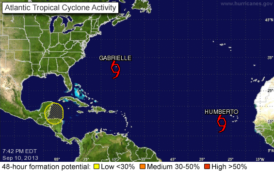
Sunday, August 25, 2013

Tropical Storm Fernand(o): August 25, Update B

Here’s my one small itsy bitsy window and I’m not going to let this go slipping through my fingers… how many ABBA song titles have I crammed into this one, and probably only, post on TS Fernand(o)? <big ABBA-Happy grin>

It will come as no surprise to you (if you read my last update), but does your mother know that TD6 got updated to TS Fernand(o) after the plane returned their findings? He is now at 19.2N, 95.8W, heading W at 9mph, with winds of 45mph, central pressure 1003mb. They say he will make landfall in about 11 hours, but maybe they are looking at another town, another train, because I think he may already be about to make his arrival in the state of Veracruz  when I look at this radar snapshot from Mexico. Really, I do, I do, I do, I do, I do!

If it wasn’t for the nights I would be able to show you a visible satellite image, but in this case a near-by radar is even better. I have a dream (a phrase oft-heard this week) that one day the storm updates will actually match what is going on in real-time! Maybe the NHC have been sitting in the palmtree today but when all is said and done, that’s not the name of the game. I hope the people in that part of Mexico were told to watch out!  I could go on and on and on about how slowly this storm was upgraded, and until it’s pretty much on land to boot, but knowing me, knowing you, the way old friends do, I’d better say so long now and move on.

Hasta manana!
J.

Blogs archived at http://jyotikastorms.blogspot.com/
Twitter @JyovianStorm

-------------------------------
DISCLAIMER: These remarks are just what I think/see regarding tropical storms - not the opinion of any organization I represent. If you are making an evacuation decision, please heed your local emergency management and the National Hurricane Center's official forecast and the National Weather Service announcements. This is not an official forecast. If I "run away, run away" (Monty Python), I'll let you know.
-----------------------------

Tropical Depression 6: August 25, Update A

Oh Mamma Mia! Be afraid. Be very afraid… of my updates with Abba references! ;-) Obviously the NHC is quivering at that thought! Their forecast shows that they plan on naming Tropical Storm Fernand(o) about 2 seconds before it makes landfall in Mexico tonight (and then they will downgrade it 3 seconds later). Naming it just before landfall is a bit silly (British understatement!).

They have just upgraded the southern Gulf of Mexico blob to Tropical Depression 6, but I think this is already weak Tropical Storm Fernand and has been for many hours (when they gave it a 70% chance it was already stronger than it is now)! I wish I’d grabbed a satellite image from this morning to show you, but here is one from about 3-4 hours ago and one I just grabbed from the website and you can see the convection is already beginning to fall apart!

The circulation has also decreased in the lower troposphere since this morning. They center is around 19.5N, 95.5W, and he’s heading W at 12mph. Winds are officially 35mph, central pressure is 1006mb. They really should have called this earlier today, not when it’s falling apart! They have sent a plane to confirm that this is a Tropical Storm for the next few hours. Sigh. Really? I like the planes and the data they provide, but really? You don’t need that to see what sort of storm this is! Sigh.

I think it’s wine-o-clock time!

Ciao for now,
J.

Blogs archived at http://jyotikastorms.blogspot.com/
Twitter @JyovianStorm

-------------------------------
DISCLAIMER: These remarks are just what I think/see regarding tropical storms - not the opinion of any organization I represent. If you are making an evacuation decision, please heed your local emergency management and the National Hurricane Center's official forecast and the National Weather Service announcements. This is not an official forecast. If I "run away, run away" (Monty Python), I'll let you know.
-----------------------------

Sunday, August 18, 2013

The Low formerly known as Erin, the GOM Blob, and the new E. Atl. Blob: August 18, Update A

This will be short and sweet – perfect for a Sunday evening. J

Tropical Depression Erin was downgraded to a Low. Her convection decreased steadily during the day, and her circulation is now only good in the lowest portions of the troposphere, so I would agree with this.  This is my last update on Erin.

The Gulf of Mexico blob is still causing some ruckus in the Gulf, as expected. No circulation, just a bunch of thunderstorms and rainy weather. But he is getting closer and closer to the western edge of the Gulf and I expect the convection to subside within a couple of days. This will be my last update on this blob.

I see there is another blob that just came off Africa. Currently it has a 10% chance of developing. Currently the circulation is a mess with no definite structure in the atmosphere, and the convection is all over the place as you can see in this IR satellite image from about 12 hours ago:

I’ll keep an eye on it of course, but it’s way too soon to say if it will amount to any sort of apple in its mother’s eye. Next one is Fernand(o).

That’s it… just in time for second-glass-of-wine o’clock! ;-)  

Toodles until the next one!
J.

Blogs archived at http://jyotikastorms.blogspot.com/
Twitter @JyovianStorm

-------------------------------
DISCLAIMER: These remarks are just what I think/see regarding tropical storms - not the opinion of any organization I represent. If you are making an evacuation decision, please heed your local emergency management and the National Hurricane Center's official forecast and the National Weather Service announcements. This is not an official forecast. If I "run away, run away" (Monty Python), I'll let you know.
-----------------------------

Tropical Depression Erin and Gulf of Mexico Blob: August 17, Update A

I *have* to share this most amazingly unusual rendition of Ludwig van Beethovan’s 9th symphony!! It was posted by Phil Plait in one of his Bad Astronomy blog posts. <An aside> I met him once (Phil, not Ludwig) and I have a book signed by him (Phil, not Ludwig). In this book he promotes a B-movie website, Stomptokyo (http://www.stomptokyo.com/). One of the owners of Stomptokyo, Chris Holland, set up and helped me maintain this blog ...and thus you see virtual karma in action. J <End aside>  

Beethovan’s 9th is played on theremins, an electrical instrument that operates by sensing the electric field generated as your hand is waved around it – so there is no actual contact with the instrument. This is so cool that I might have to watch it again for the 10th time (today)… I do highly recommend watching this video! J  

Now that you have seen/heard great achievements by humans, back to great achievements by Mother Nature (although not so great in this case, fortunately!)… ;-)

Gulf of Mexico Blob

Our Gulf of Mexico blob wasn’t stuck for too long and was on the move earlier today. He has continued to deteriorate during the day and is so disorganized now that I can’t even see a center of circulation. Convection has also decreased this evening so although he will still be in the Gulf in some form tomorrow, I think we may not see anywhere near as much convection. Because he is over warmer waters he has generated more rain and thunderstorms than TS Erin today!

Tropical Depression Erin

She has officially been downgraded to a Tropical Depression with winds of 35mph, central pressure 1008mb. The forecast says she will have dissipated on Monday. She is moving WNW at 12mph, and is located at 20.7N, 37.7W.

Hmm. I’m not sure I agree with downgrading her to a Tropical Depression at the moment (maybe tomorrow). The circulation is still pretty good in the lower half of the troposphere and she is still generating some strong convection, albeit over a smaller area:

Erin is a pernicious little storm. There are a couple of factors working against her, but she’s still hanging on! First, she is experiencing some strong wind shear from the southwest causing the clouds to stream off to the northeast as you can see in the IR satellite image. Second, there is a lot of dry air surrounding her. However, sea surface water temperatures are around 26-27 deg C with waters warmer than 26.5 deg C in the upper 75m in some areas, which is enough to allow her to keep going. It does look like she’s going to head into an area of stronger wind shear tomorrow, which is why I think she’ll deteriorate further and may be a TD by tomorrow.   

Manana kiddos!
J.

Blogs archived at http://jyotikastorms.blogspot.com/
Twitter @JyovianStorm

-------------------------------
DISCLAIMER: These remarks are just what I think/see regarding tropical storms - not the opinion of any organization I represent. If you are making an evacuation decision, please heed your local emergency management and the National Hurricane Center's official forecast and the National Weather Service announcements. This is not an official forecast. If I "run away, run away" (Monty Python), I'll let you know.
-----------------------------
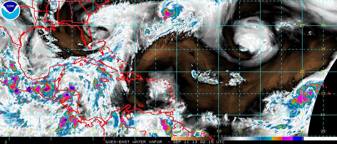
Saturday, August 17, 2013

Tropical Storm Erin and the Gulf of Mexico Blob: August 17, Update A

Friday night. Wine. Cheese. Wine. Dinner. Wine. Friends. Wine. Wine. More Food. Ice Cream (Pineapple Upside Down Cake Ice Cream!!)  Wine. Result: a rather entertaining evening and quick(ish) update. J


Tropical Storm Erin

The NHC decreased her to a Tropical Depression earlier today with winds of 30mph, but she's back up to being a weak Tropical Storm with winds of 40mph (TS range: 39-73mph), central pressure estimated to be 1006mb. I agree with her TS status. She is officially at 18.5N, 34.5N (it looks like both I and the NHC were a bit off in her track forecast yesterday). It looks like she is tracking a little east of the current center of cone estimate (maybe around 18.5N, 33.5N), so I wouldn't be surprised if her forecast track is moved slightly northward.


Her convection did take a bit of a hit today, but it has been on the increase over the last few hours. The NHC forecast keeps her as a weak storm with winds of 40mph, and by this time tomorrow they think she will be a Tropical Depression and deteriorate from there. This is quite possible. Although she is currently moving over waters of about 25-26 deg C (too cold to sustain her in the manner she is accustomed to), it looks like she will shortly move over warmer waters with surface temperatures of 26-27 deg C, and that water will be warmer than 26.5 deg C in the upper 50-75m of the water column. This warmer water will help keep her going. However, the atmosphere holds two potentially inhibiting factors in her future:  there is dry air to her west and the wind shear will increase quite a bit - both good reasons for her to weaken tomorrow.


Gulf of Mexico Blob

This little blob looked like he was going to fizzle out fairly quickly but there may be a bit of a hiccup in the making. Instead of zipping across the southern Gulf and into Mexico, he is currently stuck. There is some circulation throughout all levels of the troposphere, however there is also some wind shear from the southwest, so his center is in two different places depending on how high you look in the troposphere: It is either at 20.9N, 91.6W (low level) or at 22.5N, 90.5W (upper level). Another big inhibiting factor is the dry air to his west:


Sea surface temperatures are 29-31 deg C, which is definitely warm enough for him, with waters warmer than 26.5C in the upper ~50m. Officially the NHC give him a 40% chance of development, but they may increase this a bit tomorrow if he doesn't get his skates on! Stationary storms are always a little trickier to forecast than the usual tricky storms because while they are sitting there enjoying the view, the pressure fields around them are changing which means their track may not be as forecast. Hopefully this sitting around business is just for a handful of hours.  


That's it for tonight. I'll be awake and back tomorrow.

Night,

J.


Blogs archived at http://jyotikastorms.blogspot.com/
Twitter @JyovianStorm

-------------------------------
DISCLAIMER: These remarks are just what I think/see regarding tropical storms - not the opinion of any organization I represent. If you are making an evacuation decision, please heed your local emergency management and the National Hurricane Center's official forecast and the National Weather Service announcements. This is not an official forecast. If I "run away, run away" (Monty Python), I'll let you know.
-----------------------------

Friday, August 16, 2013

Tropical Storm Erin and the Caribbean Blob: August 15, Update A

Today is all about the number 35. I assume you heard the exciting news about the new species of animal that a team from the Smithsonian Institution found in the forests of Columbia and Ecuador, the Olinguito?

It is the first new carnivorous species to be discovered in the western hemisphere for 35 years and is, coincidentally, about 35 cm long. I saw it described today as a cross between a carnivorous teddy bear and a house cat... and all this time I’ve been operating under the premise that my house cats were carnivorous teddy bears!! Well at least that explains why they don’t like being thrown in the washing machine every couple of years, even if they do come out of the dryer fluffier than usual and smelling of fresh grass.

Also in the news today, there are rumours that my all-time favourite sci-fi tv show, Blake’s 7, is going to be re-made! Woohoo! A quality re-make is definitely long overdue!! It first aired in 1978… 35 years ago! J Drat, I should have bought a lottery ticket with 35 on it! Oh well.

I suppose I should say a couple of words about tropical storms now, huh? ;-)  

Tropical Storm Erin

As expected, she was upgraded to a weak Tropical Storm by the NHC and has remained one all day, with winds of 40mph (35 knots!) and a central pressure of 1007mb. She is currently at 15.5N, 29.1W, heading WNW at 15mph. Officially, Tropical Storm force winds extend out 35 miles from the center.

I would agree with the NHC in upgrading her to a named TS (even though they may have been a day late in doing this) and also in their assessment of how weak she was today. However it looks like she has weakened in the past few hours and no longer has very strong convection. There is still some good circulation in the lower half of the troposphere, but it is now connected to a low pressure trough. <Science Jargon Alert!> A low pressure trough is a line of lower pressure and vorticity (<jargon-in-jargon alert!> so very briefly, vorticity is a measure of how much circulation or spinning motion the atmosphere has. <end alert!>) as opposed to a circular area of low pressure (and vorticity). Tropical Storms are circular areas of low pressure. Sometimes you can see troughs in satellite images as lines of clouds, and we have an example here:

If you look at this infrared satellite image of the Atlantic you can see TS Erin at somewhere around 29W, 15.5N, and a line of clouds extending down to her south and west. Ta-da… a trough! J <End Science Jargon Alert!>

I know this is a trough and not a line of clouds from wind shear because there was a bit of wind shear out there but not enough to form this (and also because I looked at the vorticity (I’ll save that for a proper explanation another day). There doesn’t look like there will be much tomorrow either (however it looks like it will increase in a couple of days). Little wind shear means she has room to intensify of course.  Sea surface water temperatures are around 26-28 deg C, which is warm enough to sustain a storm and also allow her to grow. The two factors she has going against her is that low pressure trough and also some dry air to her northwest:

At the moment I would agree with the NHC forecast on intensity (I know, how unusual! ;-)). She will probably strengthen a bit because of the warm water and low wind shear, but in a couple of days she will be in stronger shear and hopefully in a place where there is more dry air, and that will cause her to deteriorate. I think the forecast track may be a little too northward though (according to this she’ll be around 17.5N in less than 24 hours):

I think she may maintain a more WNW track than this indicates (at least for tomorrow).

Caribbean Blob

The NHC downgraded his chances of becoming a named storm in the next 48 hours to 50%, and quite right too. But if you look at the IR satellite image, it would look like he is trying to make a comeback, isn’t he? Looks can be deceptive! The increased convection since yesterday evening in the IR satellite image above is because of the underlying deep warm waters of the Loop Current in the Gulf and not because his circulation has improved. We just had a smattering of rain from this blob up here in St. Petersburg (and quite nice it was too). He is really not very well formed and his center of circulation looks like it is actually over the Yucatan peninsula. I don’t think he will amount to too much once he gets into the Gulf, but it really depends on what shape he is in once he clears the peninsula. At the moment I would say that he would stay in the southern and western Gulf once he crosses, but because he is so weak it is difficult to assess that.

And that’s where we are today. It’s sleepy time here…I shall dream of a brave new world in which there is a brave new Blake’s 7. J

Night!
J.

Blogs archived at http://jyotikastorms.blogspot.com/
Twitter @JyovianStorm

-------------------------------
DISCLAIMER: These remarks are just what I think/see regarding tropical storms - not the opinion of any organization I represent. If you are making an evacuation decision, please heed your local emergency management and the National Hurricane Center's official forecast and the National Weather Service announcements. This is not an official forecast. If I "run away, run away" (Monty Python), I'll let you know.
-----------------------------

Wednesday, August 14, 2013

Atlantic Blobette and Caribbean Blob: August 14, Update A

Looks like there was a sale on the red crayons today! The NHC increased the chances of a Caribbean Blob and Atlantic Blobette to 70-80%. Perfect timing really as I’m back on earth for a little while, after having completed some travel in space and time (future, past, hither, thither, you name it J).

Atlantic Blobette

This blobette zipped Out of Africa all dressed up and fully coiffed, she just needs a touch of make-up and some shoes and she’s ready to boogie. Although she only emerged in the last 48 hours, she has an 80% probability of developing into a Tropical Depression in the next two days. I think we are already looking at a Tropical Depression at the very least, if not TS Erin (assuming she beats her Caribbean brother to the punch)! She is only 100 miles S-SE of the Cape Verde Islands in the eastern Atlantic, so she’s a good week or more away from getting to the western side of the Atlantic. That’s plenty of time for me to bore you all silly with my chatter! ;-)

Her convection is pretty good as you can see in this infrared satellite image:

Gosh, it’s been so long… can you remember what the colours indicate? Can I??  Hang on while I just zip back in time on the internet to look it up in here:  http://jyotikastorms.blogspot.com/2013/06/tropical-storm-andrea-june-5-update-a.html. Ah yes, thunderstorms and gallons of rain! J

Her circulation is also very good in the lower half of the troposphere (<Science Alert!> troposphere refresher… http://jyotikastorms.blogspot.com/2013/06/gulf-of-mexico-blobette-june-4-update-a.html).  She should really be weak Tropical Storm Erin already!

She’ll generally head WNW for the next few days, so nothing more on track for today.

Caribbean Blob

You can see this blob rather easily as the Big Blue Blob in the western Caribbean in this IR satellite image:

It looks like he has deteriorated a little in the past few hours. Earlier today he too was seeing red, but he is interacting a little with the land in Central America, which has resulted a decrease in his circulation and convection. But he is also interacting with the very warm and deep waters of the Caribbean (which is why there is still some heavy convection - the orange and yellow areas) so I don’t think he will go away. I would agree with the NHC that he is not yet a Tropical Storm and I’m not sure if he will become one before making landfall in the Yucatan peninsula (although he may already be a TD). Next name is Fernand... it really should be Fernando… how can I make Abba references if they have the name wrong? (oh don’t worry Chiquitita, I’ll find a way ;-)).

The models are showing landfall as a storm in the Gulf from anywhere in the Florida panhandle to Mexico which is, of course, just down the road a bit. I’ll see if I can get a better idea of what’s going on track-wise tomorrow.

Now for something almost completely different… some other Cool Science! (thanks to Doug C. for alerting me to this one). For those who saw the Perseid Meteor shower this weekend and want more Space Nerdiness (and who wouldn’t?), there is a newly discovered nova that you can see just with binoculars! Check out the details here: http://www.skyandtelescope.com/observing/home/Bright-Nova-in-Delphinus-219631281.html. <Science Alert!> A nova is an explosion in a white dwarf star (not to be confused with the dwarves you saw in The Hobbit(!!)). Our Sun is a yellow dwarf star, but this is just one phase in its life, as you can see here:

It was born, it had it's rebellious teenage years and now, in human years, I think it is in its late 30s. J In about 5.5bn years, it will become a red giant, which won’t be able to sustain itself so it will evolve again into a white dwarf! So much easier to follow than the plot of Lord of the Rings, isn’t it? ;-) <End Science Alert!>  

That’s all from me. Best get out there and look at the skies before these pesky storms come along and cloud up the view! J More tomorrow.

Toodle pip!
J.

Blogs archived at http://jyotikastorms.blogspot.com/
Twitter @JyovianStorm

-------------------------------
DISCLAIMER: These remarks are just what I think/see regarding tropical storms - not the opinion of any organization I represent. If you are making an evacuation decision, please heed your local emergency management and the National Hurricane Center's official forecast and the National Weather Service announcements. This is not an official forecast. If I "run away, run away" (Monty Python), I'll let you know.
-----------------------------

Saturday, July 27, 2013

Tropical Wave Dorian: July 27, Update A

It looks like Dorian has succumbed to the dry air and increasing wind shear and is now just waving at us from the Tropics. He is around 18.9N, 54.7W and was last spotted heading west at 24mph. A Tropical Wave doesn’t even have closed circulation… so he’s back to being a Blob. Although that’s the official verdict (the Tropical Wave bit, not the ‘Blob’ bit… that’s my version of the official verdict ;-)), I still see some circulation in the very lowest levels of the troposphere but it is diminishing so I’m ok with writing him off. He may still bring a few drops of rain to the northern Caribbean. The NHC issued their last advisory this afternoon and I will follow suit.

Meanwhile in the UK, here’s what caught my eye on the newspaper stands this morning…  

Really? Downton Abby will have a Royal twist? Really?!? (Oh, and the headline… it’s just a bit of summer rain really and has a long way to go to catch up to the tropical summer storms in Florida).

That’s all from me until Erin pops up.

Tally ho!
J.

Blogs archived at http://jyotikastorms.blogspot.com/
Twitter @JyovianStorm

-------------------------------
DISCLAIMER: These remarks are just what I think/see regarding tropical storms - not the opinion of any organization I represent. If you are making an evacuation decision, please heed your local emergency management and the National Hurricane Center's official forecast and the National Weather Service announcements. This is not an official forecast. If I "run away, run away" (Monty Python), I'll let you know.
-----------------------------

Friday, July 26, 2013

Tropical Storm Dorian: July 26, Update A

To quote Oscar Wilde: “Rather a busy day today, Phipps… distressingly little time for sloth or idleness”, so a quick update on Tropical Storm Dorian Gray. But first, a correction on yesterday’s blog, which was obviously written under the influence of too much champagne. It’s Charles Darwin who will be replaced by Jane Austen on the ten pound note, not Charles Dickens. Oopsie. J Many thanks to those who pointed it out … it has been corrected!

Tropical Storm Dorian is at 17.8N, 45.8W, moving W at a pretty rapid 22mph. His convection has really diminished during the day today, so he has been downgraded to a weak system with winds of 45mph, central pressure of 1010mb. The forecast has him as a Tropical Depression by Sunday. Sea surface temperatures are 27-28 deg C, which is definitely warm enough to sustain a storm. Wind shear is relatively weak still, so it looks like the dry air won out over the wind shear and water temperature. Here is our little Dorian in a satellite image of water vapour:

Looks like in addition to the dry air, wind shear will pick up in the next day, so I think downgrading him is a reasonable assessment.

Meanwhile, the remains of the Atlantic Blobette from a couple of days ago is lurking around Bermuda now.  Charles M. sent these two beautiful photos taken around 8.30pm last night from Bermuda:

Lovely lovely clouds! J

That’s all for today folks. Another quick update tomorrow.

Toodles!
J.

Blogs archived at http://jyotikastorms.blogspot.com/
Twitter @JyovianStorm

-------------------------------
DISCLAIMER: These remarks are just what I think/see regarding tropical storms - not the opinion of any organization I represent. If you are making an evacuation decision, please heed your local emergency management and the National Hurricane Center's official forecast and the National Weather Service announcements. This is not an official forecast. If I "run away, run away" (Monty Python), I'll let you know.
-----------------------------

Thursday, July 25, 2013

Tropical Storm Dorian: July 25, Update A

Not much time to dilly dally on Dorian today and luckily the Atlantic Blobette from yesterday seems to be dwindling, so I won’t mention her again unless she has a few classic Scottish meals of deep-fried frozen pizzas served with chips and cheese and puts on a few pounds.

Tropical Storm Dorian is at 16.5N, 37.8W heading generally WNW at 18mph. It looks like he was tracking slightly north of the center of cone track yesterday and the cone has shifted so it barely skims the VIs and Puerto Rico now:

Oscar Wilde, author of ‘The Picture of Tropical Storm Dorian Gray’ wrote “People who count their chickens before they are hatched act very wisely, because chickens run about so absurdly that it is impossible to count them accurately.” However if you live in that part of the world I wouldn’t quite count those chickens yet so don’t put the wellies away for another day or two. I agree with the NHC on the general WNW track for the next few days and how close it gets to the island isn’t clear to me. The other complication is that I’m not sure that the timing of that forecast track is correct. Both the track and timing of the storm depends on the atmospheric pressure fields and they aren’t very clear for tomorrow (at least not to me).    

He has slowly been intensifying, but is still officially a mid-intensity storm with winds of 60 mph (TS range: 39-73mph), central pressure 999mb. I think this may be fractionally on the low side because the circulation has really improved in the lower half of the troposphere and there is now a small signal in the upper troposphere. This indicates a strong Tropical Storm – maybe in the 65-70 mph range. Sea surface water temperatures are a bit warmer than yesterday, but still on the cool side at around 26 deg C and there continues to be dry air to his north and west. However wind shear remains very low. Convection is strong over a small area near the center of the storm, as you can see here:

Tomorrow he will continue to move over warmer waters, so that along with the low wind shear may be enough to allow him to continue to intensify (slowly).

I’ll continue to watch his evolution tomorrow (along with one or two other people). Speaking of evolution… (heehee)… the UK 10 pound note is about to evolve as Charles Darwin will be replaced by Jane Austen. Oh no (says the scientist in me) and woo hoo (says the bibliophile in me)!

Until tomorrow,
J.

Blogs archived at http://jyotikastorms.blogspot.com/
Twitter @JyovianStorm

-------------------------------
DISCLAIMER: These remarks are just what I think/see regarding tropical storms - not the opinion of any organization I represent. If you are making an evacuation decision, please heed your local emergency management and the National Hurricane Center's official forecast and the National Weather Service announcements. This is not an official forecast. If I "run away, run away" (Monty Python), I'll let you know.
-----------------------------

Wednesday, July 24, 2013

Tropical Storm Dorian and the Atlantic Blobette: July 24, Update A

Moving only hours faster than the UK Royal Family, Tropical Storm Dorian was ‘born’ on Monday and named earlier today. I’m in the UK this week celebrating my brother’s wedding and, of course, happened to be serendipitously here for the arrival of Prince George Alexander Louis... so er… some of these next few updates may be a little wonky depending on the champagne-o-meter! ;-)

Tropical Storm Dorian

Tropical Storm Dorian is currently at 14.3N, 29.9W heading WNW at 21mph. He is a small-to-mid Tropical Storm with winds of 50mph (TS range: 39-73mph), central pressure 1002mb. Like the new Prince, he looks like a healthy little thing as you can see in this visible satellite image:

And in this infra-red satellite image, in which he is decidedly not Dorian Gray (you didn’t think you could get away without a literary reference did you? J):

His circulation is pretty good in the lower half of the troposphere (about what I would expect for a mid-sized Tropical Storm) and the sea surface water temperature is about 27 deg C.

His official track currently takes him in the direction of the northern Caribbean and the Virgin Islands. This is quite possible, although I think he may be tracking a little to the north of the center of cone and so there is still a chance he will curve out into the Atlantic. Also, he may not be a hurricane (or a weak one if he does become one) because he is going to pass over an area of colder water and he is heading into an area of dry air which will inhibit his development and keep him in check, even though wind shear is quite weak.  I would still polish those wellington boots in preparation if I were on those islands!

Mid-Atlantic Blobette

Another little blobette popped up today and currently resides at Nowhere In Particular, The Atlantic Ocean (around 29N, 55W). Circulation is good in the lower half of the troposphere, wind shear is not very strong, and water temperatures are 29-30 deg C, so she has plenty to help her along. The one inhibiting factor is that she is in an area of dry air. I’ll keep an eye on her, but it’s too soon to say if she’s the future TS Erin.

More tomorrow of course! Time for another celebratory glass and some munchies.
J.

Blogs archived at http://jyotikastorms.blogspot.com/
Twitter @JyovianStorm

-------------------------------
DISCLAIMER: These remarks are just what I think/see regarding tropical storms - not the opinion of any organization I represent. If you are making an evacuation decision, please heed your local emergency management and the National Hurricane Center's official forecast and the National Weather Service announcements. This is not an official forecast. If I "run away, run away" (Monty Python), I'll let you know.
-----------------------------