
Hey, it's the 1st of August already! Let me check the calendar to see what this month will bring...

Attack of the Terminators! Oh Fun! ;-) But first, there are a couple of Tropical Storm-like creatures out there....
Tropical Storm Isaias
He's still being a good chap now and behaving exactly as expected. He is currently at 25.3N, 78.9W, heading NW at a slower 9mph. I expect a slow pace as he creeps up Florida - as does the NHC from the forecast track below.

The track forecast has shifted slightly westward, so it looks like he'll make initial landfall in Florida tomorrow and then scrape along the Florida and Georgia coastlines before moving over or close to the Carolinas.
He is still over the Bahamas and was kindly weakened this weekend as his center passed over Andros Island earlier today. Winds are now 70mph, central pressure is 993mb, which makes him a strong Tropical Storm. There isn't a vorticity (circulation) signal in the upper troposphere anymore, which further confirms that he is not a hurricane at the moment. However, now he's moved away from Andros Island, you can see his convection pick right back up:

That's a lot of rain and thundery weather. He'll re-intensify back to a hurricane once he leaves the Bahamas for a number of reasons:
- there won't be the weakening effect of the islands.
- he'll be over the deep warm waters of the Florida Current along the eastern coast of Florida (part of the Gulf Stream system).
- wind shear is a little weaker ahead of him for the next day or so.
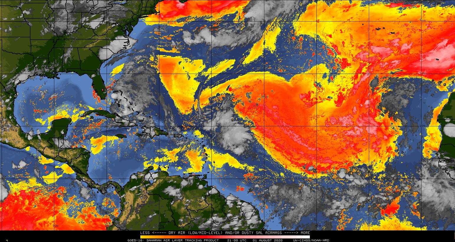
- the dry and dusty Saharan Air Layer air isn't as much of an inhibiting factor:
As for storm surge, from the tidesandcurrents website water levels are not yet a foot above normal - here's an example from Biscayne Bay, Florida:

Quick reminders of a few things: Eat ice cream. Oh, and listen to your local emergency managers because they have the best info for your area. And remember - run from the water, hide from the wind, which means that if you are in an area that gets flooded, then try and move away if you can (trickier this year, I know!). Have some wine and cheese (which is what I'm doing at the moment).
Tropical Depression 10
She's currently quite far north already at 19.2N, 23.5W heading NW at 13mph. She's actually hanging out near the Cape Verde Islands and there is hardly any circulation nor any convection to write home about:

So I'm not going to write home about this one anymore. :-)
Be back tomorrow, of course!
Toodle pip,
J.
Twitter: jyovianstorm
--------------------------------------
DISCLAIMER:
These remarks are just what I think/see regarding tropical storms - not the opinion of any organization I represent. If you are making an evacuation decision, please heed your local emergency management and the National Hurricane Center's official forecast and local weather service announcements. This is not an official forecast. If I "run away, run away" (Monty Python), I'll let you know.
--------------------------------------


No comments:
Post a Comment